Rafaḩ geodata
Rafaḩ (North Sinai) is a seat of a second-order administrative division; located in Egypt in Africa/Cairo (GMT+2) time zone. In our database, there are 135 cities with bigger population. Compared to other cities in Egypt, 94.9% of cities are located further ↓South; 95.7% of cities are located further ←West and 81.2% of cities have lower elevation than Rafaḩ. Note1


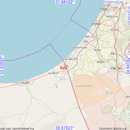
Rafaḩ GPS coordinates[2]
31° 16' 55.344" North, 34° 14' 19.284" East
| Map corner | latitude | longitude |
|---|---|---|
| Upper-left | 31.88102°, | 33.53557° |
| Center: | 31.28204°, | 34.23869° |
| Lower-right: | 30.67923°, | 34.94182° |
| Map W x H: | 133.6×133.6 km | = 83×83mi |
| max Lat: | 31.5084° ⇑5.1% North |
| Rafaḩ: | 31.28204° |
| min Lat: | ⇓94.9% South 22.3457° |
| min Long | Rafaḩ | max Long |
| 25.51965° | 34.23869° | 34.89572° |
| W 95.7%⇐ | ⇒4.3% E |
Elevation
Elevation of Rafaḩ is 60 m = 197 ft, and this is 16.5 m = 54 ft above average elevation for this country.
| Max E: |
1565 m = 5135 ft | 18.8% |
| Rafaḩ | 60 m 197 ft | |
| Avg. | 43.5 m = 143 ft | |
Min E: |
-15 m = -49 ft | 81.2% |
See also: Egypt elevation on elevation.city.
Geographical zone
Rafaḩ is located in North temperate zone (between Tropic of Cancer and the Arctic Circle). Distance of this Northern Tropic circle is 872.3 km =542 mi to South.| Distance of | km | miles | from Rafaḩ |
|---|---|---|---|
| North Pole | 6528.8 | 4056.8 | to North |
| Arctic Circle | 3922.9 | 2437.6 | to North |
| Tropic Cancer | 872.3 | 542 | to South |
| Equator | 3478.2 | 2161.3 | to South |


Nearby cities:
15 places around Rafaḩ: (largest is in red/bold)
• Al Jammālīyah
226 km =140.4 mi,  267°
267°
• Al Manzalah
219.4 km =136.3 mi, 266°
• Al Maţarīyah
210.2 km =130.6 mi, 266°
• Arish
45.1 km =28 mi,  248°
248°
• Ash Shaykh Zuwayd
14.2 km =8.8 mi,  238°
238°
• Bi’r al ‘Abd
120.5 km =74.9 mi,  255°
255°
• Damietta
230.8 km =143.4 mi, 273°
• Fāqūs
240.7 km =149.6 mi, 255°
• Fāraskūr
239.8 km =149 mi, 271°
• Ismailia
202.1 km =125.6 mi, 248°
• Minyat an Naşr
247.4 km =153.7 mi, 265°
• Port Said
185.8 km =115.5 mi, 269°
• Suez
219.1 km =136.1 mi,  228°
228°
• Taba
208.8 km =129.7 mi,  162°
162°
• ‘Izbat al Burj
228.9 km =142.2 mi,  276°
276°
Sources, notices
• [Note1] Compared only with cities in Egypt existing in our database
• [Src1] Map data: © OpenStreetMap contributors (CC-BY-SA)
• [Src2] Other city data from geonames.org with taken over terms of usage.
• [Src3] Geographical zone / Annual Mean Temperature by Robert A. Rohde @ Wikipedia
