Segurilla geodata
Segurilla (Castille-La Mancha) is a seat of a third-order administrative division; located in Spain in Europe/Madrid (GMT+2) time zone. With population of 1,132 people, there are 2792 cities with bigger population in this country. Compared to other cities in Spain, 69.9% of cities are located further ↑North; 70.7% of cities are located further →East and 57% of cities have higher elevation than Segurilla. Note1
Administrative division(s):
- Level 1: Castille-La Mancha
- Level 2: Province of Toledo
- Level 3: Segurilla


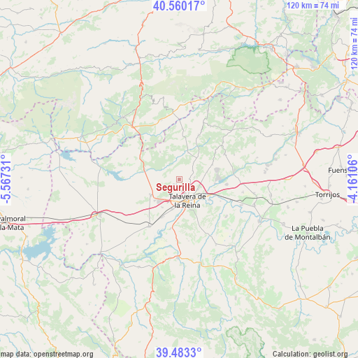
Segurilla GPS coordinates[2]
40° 1' 25.896" North, 4° 51' 51.048" West
| Map corner | latitude | longitude |
|---|---|---|
| Upper-left | 40.56017°, | -5.56731° |
| Center: | 40.02386°, | -4.86418° |
| Lower-right: | 39.4833°, | -4.16106° |
| Map W x H: | 119.7×119.7 km | = 74.4×74.4mi |
| max Lat: | 43.74134° ⇑69.9% North |
| Segurilla: | 40.02386° |
| min Lat: | ⇓30.1% South 27.64134° |
| min Long | Segurilla | max Long |
| -18.00367° | -4.86418° | 4.2899° |
| W 29.3%⇐ | ⇒70.7% E |
Elevation
Elevation of Segurilla is 566 m = 1857 ft, and this is 32 m = 105 ft below average elevation for this country.
| Max E: |
1682 m = 5518 ft | 57% |
| Avg. | 598 m = 1962 ft | |
| Segurilla | 566 m = 1857 ft | |
Min E: |
0 m = 0 ft | 43% |
See also: Spain elevation on elevation.city.
Geographical zone
Segurilla is located in North temperate zone (between Tropic of Cancer and the Arctic Circle). Distance of this Northern Tropic circle is 1844.3 km =1146 mi to South.| Distance of | km | miles | from Segurilla |
|---|---|---|---|
| North Pole | 5556.8 | 3452.8 | to North |
| Arctic Circle | 2950.9 | 1833.6 | to North |
| Tropic Cancer | 1844.3 | 1146 | to South |
| Equator | 4450.2 | 2765.2 | to South |


Nearby cities:
15 places around Segurilla: (largest is in red/bold)
• Buenaventura
17.1 km =10.6 mi,  4°
4°
• Cardiel de los Montes
18.4 km =11.4 mi,  76°
76°
• Castillo de Bayuela
17.4 km =10.8 mi,  60°
60°
• Cazalegas
16.1 km =10 mi,  95°
95°
• Cervera de los Montes
5.5 km =3.4 mi, 55°
• Gamonal
10.9 km =6.8 mi,  229°
229°
• Hinojosa de San Vicente
15 km =9.3 mi,  53°
53°
• Las Herencias
17.9 km =11.1 mi,  196°
196°
• Mejorada
2.4 km =1.5 mi, 228°
• Montesclaros
11.2 km =7 mi,  325°
325°
• Navamorcuende
16.2 km =10.1 mi,  24°
24°
• Parrillas
17.5 km =10.9 mi,  284°
284°
• Sotillo de las Palomas
9.4 km =5.8 mi, 19°
• Talavera de la Reina
7.3 km =4.5 mi,  157°
157°
• Velada
10.9 km =6.8 mi,  241°
241°
Sources, notices
• [Note1] Compared only with cities in Spain existing in our database
• [Src1] Map data: © OpenStreetMap contributors (CC-BY-SA)
• [Src2] Other city data from geonames.org with taken over terms of usage.
• [Src3] Geographical zone / Annual Mean Temperature by Robert A. Rohde @ Wikipedia
