Mejorada geodata
Mejorada (Castille-La Mancha) is a seat of a third-order administrative division; located in Spain in Europe/Madrid (GMT+2) time zone. With population of 1,272 people, there are 2664 cities with bigger population in this country. Compared to other cities in Spain, 70.1% of cities are located further ↑North; 70.9% of cities are located further →East and 58.1% of cities have higher elevation than Mejorada. Note1
Administrative division(s):
- Level 1: Castille-La Mancha
- Level 2: Province of Toledo
- Level 3: Mejorada


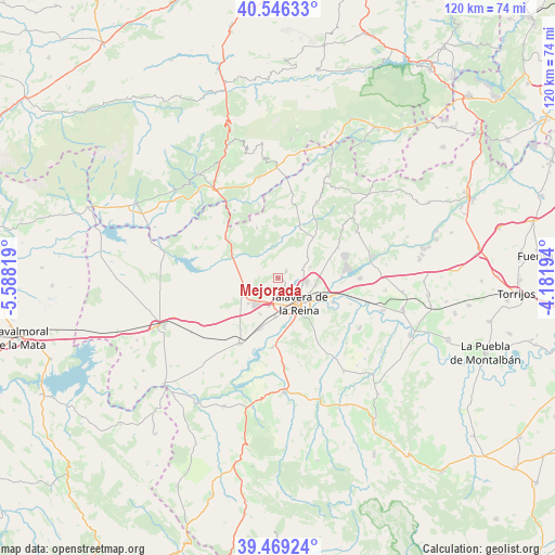
Mejorada GPS coordinates[2]
40° 0' 35.676" North, 4° 53' 6.216" West
| Map corner | latitude | longitude |
|---|---|---|
| Upper-left | 40.54633°, | -5.58819° |
| Center: | 40.00991°, | -4.88506° |
| Lower-right: | 39.46924°, | -4.18194° |
| Map W x H: | 119.8×119.8 km | = 74.4×74.4mi |
| max Lat: | 43.74134° ⇑70.1% North |
| Mejorada: | 40.00991° |
| min Lat: | ⇓29.9% South 27.64134° |
| min Long | Mejorada | max Long |
| -18.00367° | -4.88506° | 4.2899° |
| W 29.1%⇐ | ⇒70.9% E |
Elevation
Elevation of Mejorada is 551 m = 1808 ft, and this is 47 m = 154 ft below average elevation for this country.
| Max E: |
1682 m = 5518 ft | 58.1% |
| Avg. | 598 m = 1962 ft | |
| Mejorada | 551 m = 1808 ft | |
Min E: |
0 m = 0 ft | 41.9% |
See also: Spain elevation on elevation.city.
Geographical zone
Mejorada is located in North temperate zone (between Tropic of Cancer and the Arctic Circle). Distance of this Northern Tropic circle is 1842.8 km =1145.1 mi to South.| Distance of | km | miles | from Mejorada |
|---|---|---|---|
| North Pole | 5558.4 | 3453.8 | to North |
| Arctic Circle | 2952.5 | 1834.6 | to North |
| Tropic Cancer | 1842.8 | 1145.1 | to South |
| Equator | 4448.7 | 2764.3 | to South |


Nearby cities:
15 places around Mejorada: (largest is in red/bold)
• Buenaventura
18.8 km =11.7 mi,  9°
9°
• Calera y Chozas
16.4 km =10.2 mi,  210°
210°
• Cazalegas
17.8 km =11.1 mi,  90°
90°
• Cervera de los Montes
7.9 km =4.9 mi,  53°
53°
• Gamonal
8.5 km =5.3 mi,  230°
230°
• Hinojosa de San Vicente
17.4 km =10.8 mi, 52°
• Las Herencias
16 km =9.9 mi,  191°
191°
• Montesclaros
11.7 km =7.3 mi,  337°
337°
• Navalcán
18 km =11.2 mi,  290°
290°
• Navamorcuende
18.3 km =11.4 mi,  27°
27°
• Parrillas
16.3 km =10.1 mi, 290°
• Segurilla
2.4 km =1.5 mi, 48°
• Sotillo de las Palomas
11.5 km =7.1 mi, 25°
• Talavera de la Reina
6.9 km =4.3 mi,  138°
138°
• Velada
8.6 km =5.3 mi,  244°
244°
Sources, notices
• [Note1] Compared only with cities in Spain existing in our database
• [Src1] Map data: © OpenStreetMap contributors (CC-BY-SA)
• [Src2] Other city data from geonames.org with taken over terms of usage.
• [Src3] Geographical zone / Annual Mean Temperature by Robert A. Rohde @ Wikipedia
