Yecla geodata
Yecla (Murcia) is a seat of a third-order administrative division; located in Spain in Europe/Madrid (GMT+2) time zone. With population of 35,025 people, there are 258 cities with bigger population in this country. Compared to other cities in Spain, 84.9% of cities are located further ↑North; 76.2% of cities are located further ←West and 53.3% of cities have higher elevation than Yecla. Note1


Yecla GPS coordinates[2]
38° 36' 49.14" North, 1° 6' 52.848" West
| Map corner | latitude | longitude |
|---|---|---|
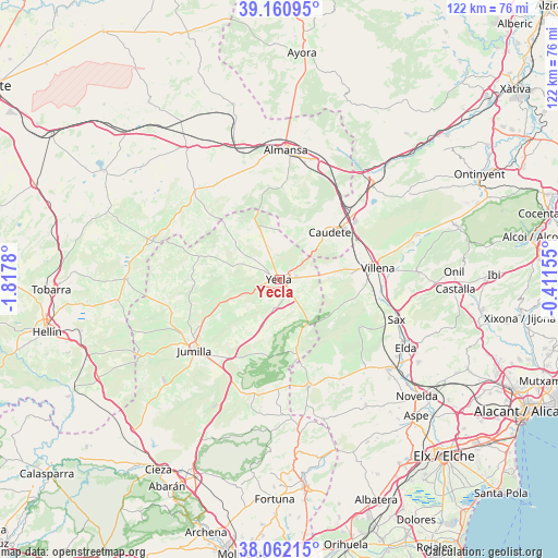
| Upper-left | 39.16095°, | -1.8178° |
| Center: | 38.61365°, | -1.11468° |
| Lower-right: | 38.06215°, | -0.41155° |
| Map W x H: | 122.2×122.2 km | = 75.9×75.9mi |
| max Lat: | 43.74134° ⇑84.9% North |
| Yecla: | 38.61365° |
| min Lat: | ⇓15.1% South 27.64134° |
| min Long | Yecla | max Long |
| -18.00367° | -1.11468° | 4.2899° |
| W 76.2%⇐ | ⇒23.8% E |
Elevation
Elevation of Yecla is 620 m = 2034 ft, and this is 22 m = 72 ft above average elevation for this country.
| Max E: |
1682 m = 5518 ft | 53.3% |
| Yecla | 620 m 2034 ft | |
| Avg. | 598 m = 1962 ft | |
Min E: |
0 m = 0 ft | 46.7% |
See also: Spain elevation on elevation.city.
Geographical zone
Yecla is located in North temperate zone (between Tropic of Cancer and the Arctic Circle). Distance of this Northern Tropic circle is 1687.5 km =1048.6 mi to South.| Distance of | km | miles | from Yecla |
|---|---|---|---|
| North Pole | 5713.6 | 3550.3 | to North |
| Arctic Circle | 3107.7 | 1931 | to North |
| Tropic Cancer | 1687.5 | 1048.6 | to South |
| Equator | 4293.4 | 2667.8 | to South |


Nearby cities:
15 places around Yecla: (largest is in red/bold)
• Almansa
28.5 km =17.7 mi,  3°
3°
• Beneixama
31.7 km =19.7 mi,  72°
72°
• Biar
30.5 km =19 mi,  86°
86°
• Caudete
15.2 km =9.4 mi,  46°
46°
• Cañada
27 km =16.8 mi,  75°
75°
• Elda
31.9 km =19.8 mi,  118°
118°
• Fuente-Álamo
28.9 km =18 mi,  287°
287°
• Jumilla
23.6 km =14.7 mi,  230°
230°
• La Font de la Figuera
28.8 km =17.9 mi,  44°
44°
• Montealegre del Castillo
26.8 km =16.7 mi,  316°
316°
• Monóvar
30.8 km =19.1 mi,  129°
129°
• Pinoso
24.4 km =15.2 mi,  164°
164°
• Salinas
20.5 km =12.7 mi, 120°
• Sax
27.2 km =16.9 mi,  108°
108°
• Villena
21.8 km =13.5 mi, 83°
Sources, notices
• [Note1] Compared only with cities in Spain existing in our database
• [Src1] Map data: © OpenStreetMap contributors (CC-BY-SA)
• [Src2] Other city data from geonames.org with taken over terms of usage.
• [Src3] Geographical zone / Annual Mean Temperature by Robert A. Rohde @ Wikipedia
