Cóbdar geodata
Cóbdar (Andalusia) is a seat of a third-order administrative division; located in Spain in Europe/Madrid (GMT+2) time zone. With population of 251 people, there are 4734 cities with bigger population in this country. Compared to other cities in Spain, 93.3% of cities are located further ↑North; 64.6% of cities are located further ←West and 53.3% of cities have higher elevation than Cóbdar. Note1


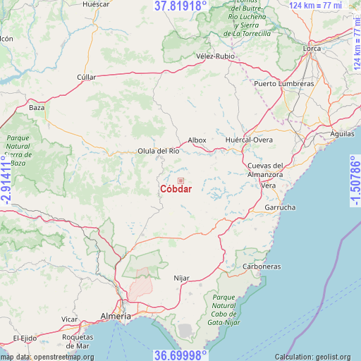
Cóbdar GPS coordinates[2]
37° 15' 41.976" North, 2° 12' 39.528" West
| Map corner | latitude | longitude |
|---|---|---|
| Upper-left | 37.81918°, | -2.91411° |
| Center: | 37.26166°, | -2.21098° |
| Lower-right: | 36.69998°, | -1.50786° |
| Map W x H: | 124.4×124.4 km | = 77.3×77.3mi |
| max Lat: | 43.74134° ⇑93.3% North |
| Cóbdar: | 37.26166° |
| min Lat: | ⇓6.7% South 27.64134° |
| min Long | Cóbdar | max Long |
| -18.00367° | -2.21098° | 4.2899° |
| W 64.6%⇐ | ⇒35.4% E |
Elevation
Elevation of Cóbdar is 620 m = 2034 ft, and this is 22 m = 72 ft above average elevation for this country.
| Max E: |
1682 m = 5518 ft | 53.3% |
| Cóbdar | 620 m 2034 ft | |
| Avg. | 598 m = 1962 ft | |
Min E: |
0 m = 0 ft | 46.7% |
See also: Spain elevation on elevation.city.
Geographical zone
Cóbdar is located in North temperate zone (between Tropic of Cancer and the Arctic Circle). Distance of this Northern Tropic circle is 1537.2 km =955.2 mi to South.| Distance of | km | miles | from Cóbdar |
|---|---|---|---|
| North Pole | 5864 | 3643.7 | to North |
| Arctic Circle | 3258.1 | 2024.5 | to North |
| Tropic Cancer | 1537.2 | 955.2 | to South |
| Equator | 4143.1 | 2574.4 | to South |


Nearby cities:
15 places around Cóbdar: (largest is in red/bold)
• Albox
15.1 km =9.4 mi,  21°
21°
• Albánchez
3.5 km =2.2 mi,  46°
46°
• Alcudia de Monteagud
5.7 km =3.5 mi,  239°
239°
• Arboleas
15.6 km =9.7 mi, 50°
• Benitagla
4.2 km =2.6 mi,  216°
216°
• Benizalón
6.1 km =3.8 mi,  206°
206°
• Cantoria
10.1 km =6.3 mi,  9°
9°
• Chercos
5 km =3.1 mi,  260°
260°
• Fines
11.8 km =7.3 mi,  339°
339°
• Laroya
11.6 km =7.2 mi,  290°
290°
• Lubrín
13.8 km =8.6 mi,  111°
111°
• Macael
11.2 km =7 mi,  315°
315°
• Olula del Río
12.8 km =8 mi, 323°
• Tahal
7.5 km =4.7 mi, 240°
• Uleila del Campo
8.6 km =5.3 mi,  176°
176°
Sources, notices
• [Note1] Compared only with cities in Spain existing in our database
• [Src1] Map data: © OpenStreetMap contributors (CC-BY-SA)
• [Src2] Other city data from geonames.org with taken over terms of usage.
• [Src3] Geographical zone / Annual Mean Temperature by Robert A. Rohde @ Wikipedia
