Alburquerque geodata
Alburquerque (Extremadura) is a seat of a third-order administrative division; located in Spain in Europe/Madrid (GMT+2) time zone. With population of 5,619 people, there are 1191 cities with bigger population in this country. Compared to other cities in Spain, 79.3% of cities are located further ↑North; 94.3% of cities are located further →East and 67.5% of cities have higher elevation than Alburquerque. Note1
Administrative division(s):
- Level 1: Extremadura
- Level 2: Provincia de Badajoz
- Level 3: Alburquerque


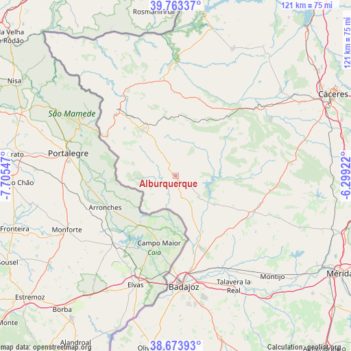
Alburquerque GPS coordinates[2]
39° 13' 14.736" North, 7° 0' 8.424" West
| Map corner | latitude | longitude |
|---|---|---|
| Upper-left | 39.76337°, | -7.70547° |
| Center: | 39.22076°, | -7.00234° |
| Lower-right: | 38.67393°, | -6.29922° |
| Map W x H: | 121.1×121.1 km | = 75.2×75.2mi |
| max Lat: | 43.74134° ⇑79.3% North |
| Alburquerque: | 39.22076° |
| min Lat: | ⇓20.7% South 27.64134° |
| min Long | Alburquerque | max Long |
| -18.00367° | -7.00234° | 4.2899° |
| W 5.7%⇐ | ⇒94.3% E |
Elevation
Elevation of Alburquerque is 426 m = 1398 ft, and this is 172 m = 564 ft below average elevation for this country.
| Max E: |
1682 m = 5518 ft | 67.5% |
| Avg. | 598 m = 1962 ft | |
| Alburquerque | 426 m = 1398 ft | |
Min E: |
0 m = 0 ft | 32.5% |
See also: Spain elevation on elevation.city.
Geographical zone
Alburquerque is located in North temperate zone (between Tropic of Cancer and the Arctic Circle). Distance of this Northern Tropic circle is 1755 km =1090.5 mi to South.| Distance of | km | miles | from Alburquerque |
|---|---|---|---|
| North Pole | 5646.1 | 3508.3 | to North |
| Arctic Circle | 3040.2 | 1889.1 | to North |
| Tropic Cancer | 1755 | 1090.5 | to South |
| Equator | 4360.9 | 2709.7 | to South |


Nearby cities:
15 places around Alburquerque: (largest is in red/bold)
• Aliseda
34.9 km =21.7 mi,  49°
49°
• Arroyo de la Luz
46.4 km =28.8 mi, 50°
• Badajoz
38.2 km =23.7 mi,  175°
175°
• Carbajo
45.7 km =28.4 mi,  338°
338°
• La Codosera
14.8 km =9.2 mi,  264°
264°
• La Nava de Santiago
46.3 km =28.8 mi,  112°
112°
• La Roca de la Sierra
29.7 km =18.5 mi, 114°
• Membrío
34.3 km =21.3 mi,  352°
352°
• Puebla de Obando
32.7 km =20.3 mi,  98°
98°
• Salorino
28.8 km =17.9 mi,  359°
359°
• San Vicente de Alcántara
19.5 km =12.1 mi,  323°
323°
• Talavera La Real
43.1 km =26.8 mi,  152°
152°
• Valdelacalzada
45.1 km =28 mi,  144°
144°
• Valencia de Alcántara
29.7 km =18.5 mi, 315°
• Villar del Rey
16.5 km =10.3 mi,  126°
126°
Sources, notices
• [Note1] Compared only with cities in Spain existing in our database
• [Src1] Map data: © OpenStreetMap contributors (CC-BY-SA)
• [Src2] Other city data from geonames.org with taken over terms of usage.
• [Src3] Geographical zone / Annual Mean Temperature by Robert A. Rohde @ Wikipedia
