San Vicente de Alcántara geodata
San Vicente de Alcántara (Extremadura) is a seat of a third-order administrative division; located in Spain in Europe/Madrid (GMT+2) time zone. In our database, there are 6762 cities with bigger population. Compared to other cities in Spain, 78.2% of cities are located further ↑North; 94.6% of cities are located further →East and 61.5% of cities have higher elevation than San Vicente de Alcántara. Note1
Administrative division(s):
- Level 1: Extremadura
- Level 2: Provincia de Badajoz
- Level 3: San Vicente de Alcántara
Current local time in San Vicente de Alcántara:
11:57 PM, ThursdayDifference from your time zone: hours


San Vicente de Alcántara GPS coordinates[2]
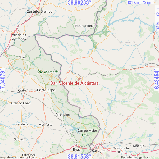
39° 21' 40.752" North, 7° 8' 15.576" West
| Map corner | latitude | longitude |
|---|---|---|
| Upper-left | 39.90283°, | -7.84079° |
| Center: | 39.36132°, | -7.13766° |
| Lower-right: | 38.81558°, | -6.43454° |
| Map W x H: | 120.9×120.9 km | = 75.1×75.1mi |
| max Lat: | 43.74134° ⇑78.2% North |
| San Vicente de Alcántara: | 39.36132° |
| min Lat: | ⇓21.8% South 27.64134° |
| min Long | San Vicente de | max Long |
| -18.00367° | -7.13766° | 4.2899° |
| W 5.4%⇐ | ⇒94.6% E |
Elevation
Elevation of San Vicente de Alcántara is 504 m = 1654 ft, and this is 94 m = 308 ft below average elevation for this country.
| Max E: |
1682 m = 5518 ft | 61.5% |
| Avg. | 598 m = 1962 ft | |
| San Vicente de Alcántara | 504 m = 1654 ft | |
Min E: |
0 m = 0 ft | 38.5% |
See also: Spain elevation on elevation.city.
Geographical zone
San Vicente de Alcántara is located in North temperate zone (between Tropic of Cancer and the Arctic Circle). Distance of this Northern Tropic circle is 1770.6 km =1100.2 mi to South.| Distance of | km | miles | from San Vicente de Alcántara |
|---|---|---|---|
| North Pole | 5630.5 | 3498.6 | to North |
| Arctic Circle | 3024.6 | 1879.4 | to North |
| Tropic Cancer | 1770.6 | 1100.2 | to South |
| Equator | 4376.6 | 2719.5 | to South |


Nearby cities:
15 places around San Vicente de Alcántara: (largest is in red/bold)
• Alburquerque
19.5 km =12.1 mi,  143°
143°
• Alcántara
45.3 km =28.1 mi,  28°
28°
• Aliseda
38.9 km =24.2 mi,  79°
79°
• Brozas
41.7 km =25.9 mi,  47°
47°
• Carbajo
27.4 km =17 mi,  349°
349°
• Cedillo
44.7 km =27.8 mi,  316°
316°
• Herrera de Alcántara
38.5 km =23.9 mi, 323°
• La Codosera
17.2 km =10.7 mi,  190°
190°
• La Roca de la Sierra
47.7 km =29.6 mi,  125°
125°
• Membrío
19.8 km =12.3 mi,  21°
21°
• Salorino
17.3 km =10.7 mi,  40°
40°
• Santiago de Alcántara
28.8 km =17.9 mi,  341°
341°
• Valencia de Alcántara
10.7 km =6.6 mi,  301°
301°
• Villa del Rey
42.9 km =26.7 mi, 39°
• Villar del Rey
35.6 km =22.1 mi, 135°
Sources, notices
• [Note1] Compared only with cities in Spain existing in our database
• [Src1] Map data: © OpenStreetMap contributors (CC-BY-SA)
• [Src2] Other city data from geonames.org with taken over terms of usage.
• [Src3] Geographical zone / Annual Mean Temperature by Robert A. Rohde @ Wikipedia
