Valtorres geodata
Valtorres (Aragon) is a seat of a third-order administrative division; located in Spain in Europe/Madrid (GMT+2) time zone. With population of 117 people, there are 5732 cities with bigger population in this country. Compared to other cities in Spain, 55.3% of cities are located further ↓South; 70.1% of cities are located further ←West and 51.4% of cities have lower elevation than Valtorres. Note1


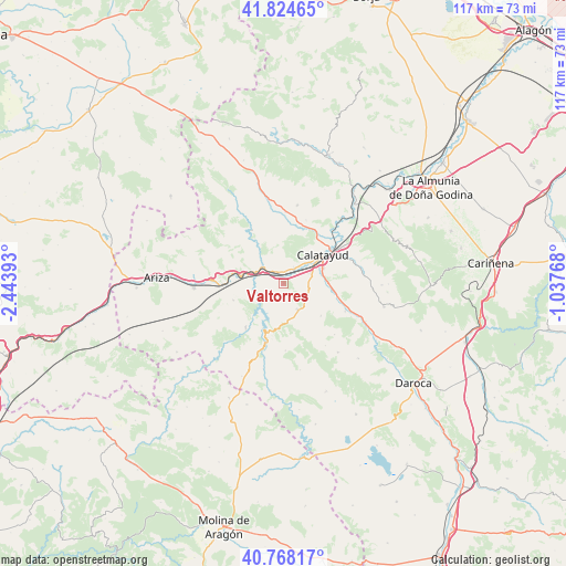
Valtorres GPS coordinates[2]
41° 17' 54.78" North, 1° 44' 26.88" West
| Map corner | latitude | longitude |
|---|---|---|
| Upper-left | 41.82465°, | -2.44393° |
| Center: | 41.29855°, | -1.7408° |
| Lower-right: | 40.76817°, | -1.03768° |
| Map W x H: | 117.5×117.5 km | = 73×73mi |
| max Lat: | 43.74134° ⇑44.7% North |
| Valtorres: | 41.29855° |
| min Lat: | ⇓55.3% South 27.64134° |
| min Long | Valtorres | max Long |
| -18.00367° | -1.7408° | 4.2899° |
| W 70.1%⇐ | ⇒29.9% E |
Elevation
Elevation of Valtorres is 673 m = 2208 ft, and this is 75 m = 246 ft above average elevation for this country.
| Max E: |
1682 m = 5518 ft | 48.6% |
| Valtorres | 673 m 2208 ft | |
| Avg. | 598 m = 1962 ft | |
Min E: |
0 m = 0 ft | 51.4% |
See also: Spain elevation on elevation.city.
Geographical zone
Valtorres is located in North temperate zone (between Tropic of Cancer and the Arctic Circle). Distance of this Northern Tropic circle is 1986 km =1234 mi to South.| Distance of | km | miles | from Valtorres |
|---|---|---|---|
| North Pole | 5415.1 | 3364.8 | to North |
| Arctic Circle | 2809.2 | 1745.6 | to North |
| Tropic Cancer | 1986 | 1234 | to South |
| Equator | 4592 | 2853.3 | to South |


Nearby cities:
15 places around Valtorres: (largest is in red/bold)
• Alhama de Aragón
12.8 km =8 mi,  269°
269°
• Ateca
5.7 km =3.5 mi,  309°
309°
• Bubierca
9.6 km =6 mi,  280°
280°
• Calatayud
10.2 km =6.3 mi,  53°
53°
• Carenas
5.3 km =3.3 mi,  243°
243°
• Castejón de las Armas
6 km =3.7 mi, 282°
• Godojos
10.8 km =6.7 mi,  251°
251°
• Ibdes
11.9 km =7.4 mi,  220°
220°
• Maluenda
10.5 km =6.5 mi,  96°
96°
• Munébrega
6 km =3.7 mi,  150°
150°
• Nuévalos
10.5 km =6.5 mi,  202°
202°
• Olvés
10.2 km =6.3 mi,  129°
129°
• Paracuellos de Jiloca
8.6 km =5.3 mi,  78°
78°
• Terrer
4 km =2.5 mi,  34°
34°
• Velilla de Jiloca
11.7 km =7.3 mi, 102°
Sources, notices
• [Note1] Compared only with cities in Spain existing in our database
• [Src1] Map data: © OpenStreetMap contributors (CC-BY-SA)
• [Src2] Other city data from geonames.org with taken over terms of usage.
• [Src3] Geographical zone / Annual Mean Temperature by Robert A. Rohde @ Wikipedia
