Preixens geodata
Preixens (Catalonia) is a populated place; located in Spain in Europe/Madrid (GMT+2) time zone. With population of 509 people, there are 3858 cities with bigger population in this country. Compared to other cities in Spain, 68.4% of cities are located further ↓South; 90.7% of cities are located further ←West and 73.9% of cities have higher elevation than Preixens. Note1


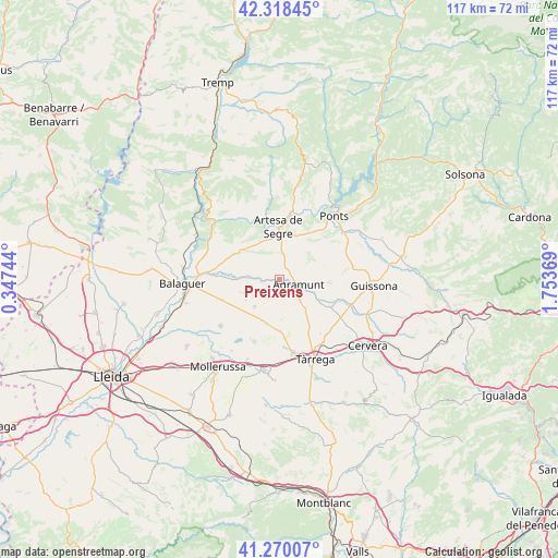
Preixens GPS coordinates[2]
41° 47' 47.04" North, 1° 3' 2.052" East
| Map corner | latitude | longitude |
|---|---|---|
| Upper-left | 42.31845°, | 0.34744° |
| Center: | 41.7964°, | 1.05057° |
| Lower-right: | 41.27007°, | 1.75369° |
| Map W x H: | 116.6×116.6 km | = 72.5×72.5mi |
| max Lat: | 43.74134° ⇑31.6% North |
| Preixens: | 41.7964° |
| min Lat: | ⇓68.4% South 27.64134° |
| min Long | Preixens | max Long |
| -18.00367° | 1.05057° | 4.2899° |
| W 90.7%⇐ | ⇒9.3% E |
Elevation
Elevation of Preixens is 317 m = 1040 ft, and this is 281 m = 922 ft below average elevation for this country.
| Max E: |
1682 m = 5518 ft | 73.9% |
| Avg. | 598 m = 1962 ft | |
| Preixens | 317 m = 1040 ft | |
Min E: |
0 m = 0 ft | 26.1% |
See also: Spain elevation on elevation.city.
Geographical zone
Preixens is located in North temperate zone (between Tropic of Cancer and the Arctic Circle). Distance of this Northern Tropic circle is 2041.4 km =1268.5 mi to South.| Distance of | km | miles | from Preixens |
|---|---|---|---|
| North Pole | 5359.7 | 3330.4 | to North |
| Arctic Circle | 2753.9 | 1711.2 | to North |
| Tropic Cancer | 2041.4 | 1268.5 | to South |
| Equator | 4647.3 | 2887.7 | to South |


Nearby cities:
15 places around Preixens: (largest is in red/bold)
• Agramunt
4 km =2.5 mi,  105°
105°
• Anglesola
15.8 km =9.8 mi,  170°
170°
• Artesa de Segre
10.9 km =6.8 mi,  358°
358°
• Barbens
13.4 km =8.3 mi,  191°
191°
• Bellcaire d'Urgell
12.2 km =7.6 mi,  245°
245°
• Camarasa
16.7 km =10.4 mi,  301°
301°
• Castellserà
6.6 km =4.1 mi,  219°
219°
• Cubells
9.7 km =6 mi,  308°
308°
• Ivars d'Urgell
14 km =8.7 mi,  202°
202°
• La Fuliola
9.6 km =6 mi, 196°
• Linyola
15.4 km =9.6 mi,  226°
226°
• Montgai
7 km =4.3 mi,  273°
273°
• Ossó de Sió
10.1 km =6.3 mi,  117°
117°
• Penelles
8.7 km =5.4 mi, 233°
• Tornabous
10.6 km =6.6 mi,  178°
178°
Sources, notices
• [Note1] Compared only with cities in Spain existing in our database
• [Src1] Map data: © OpenStreetMap contributors (CC-BY-SA)
• [Src2] Other city data from geonames.org with taken over terms of usage.
• [Src3] Geographical zone / Annual Mean Temperature by Robert A. Rohde @ Wikipedia
