Artesa de Segre geodata
Artesa de Segre (Catalonia) is a seat of a third-order administrative division; located in Spain in Europe/Madrid (GMT+2) time zone. With population of 3,657 people, there are 1549 cities with bigger population in this country. Compared to other cities in Spain, 70.8% of cities are located further ↓South; 90.6% of cities are located further ←West and 73% of cities have higher elevation than Artesa de Segre. Note1
Administrative division(s):
- Level 1: Catalonia
- Level 2: Província de Lleida
- Level 3: Artesa de Segre


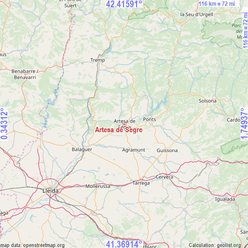
Artesa de Segre GPS coordinates[2]
41° 53' 40.812" North, 1° 2' 46.5" East
| Map corner | latitude | longitude |
|---|---|---|
| Upper-left | 42.41591°, | 0.34312° |
| Center: | 41.89467°, | 1.04625° |
| Lower-right: | 41.36914°, | 1.74937° |
| Map W x H: | 116.4×116.4 km | = 72.3×72.3mi |
| max Lat: | 43.74134° ⇑29.2% North |
| Artesa de Segre: | 41.89467° |
| min Lat: | ⇓70.8% South 27.64134° |
| min Long | Artesa de Segre | max Long |
| -18.00367° | 1.04625° | 4.2899° |
| W 90.6%⇐ | ⇒9.4% E |
Elevation
Elevation of Artesa de Segre is 333 m = 1093 ft, and this is 265 m = 869 ft below average elevation for this country.
| Max E: |
1682 m = 5518 ft | 73% |
| Avg. | 598 m = 1962 ft | |
| Artesa de Segre | 333 m = 1093 ft | |
Min E: |
0 m = 0 ft | 27% |
See also: Spain elevation on elevation.city.
Geographical zone
Artesa de Segre is located in North temperate zone (between Tropic of Cancer and the Arctic Circle). Distance of this Northern Tropic circle is 2052.3 km =1275.2 mi to South.| Distance of | km | miles | from Artesa de Segre |
|---|---|---|---|
| North Pole | 5348.8 | 3323.6 | to North |
| Arctic Circle | 2742.9 | 1704.4 | to North |
| Tropic Cancer | 2052.3 | 1275.2 | to South |
| Equator | 4658.3 | 2894.5 | to South |


Nearby cities:
15 places around Artesa de Segre: (largest is in red/bold)
• Agramunt
12.7 km =7.9 mi,  160°
160°
• Balaguer
22.6 km =14 mi,  239°
239°
• Bellcaire d'Urgell
19.3 km =12 mi,  213°
213°
• Camarasa
14.1 km =8.8 mi,  261°
261°
• Castellserà
16.5 km =10.3 mi,  193°
193°
• Cubells
8.7 km =5.4 mi, 235°
• La Fuliola
20.3 km =12.6 mi, 186°
• Llimiana
22.7 km =14.1 mi,  331°
331°
• Montgai
12.4 km =7.7 mi, 212°
• Ossó de Sió
18.1 km =11.2 mi,  148°
148°
• Penelles
17.4 km =10.8 mi,  202°
202°
• Ponts
11.7 km =7.3 mi,  78°
78°
• Preixens
10.9 km =6.8 mi,  178°
178°
• Tiurana
19.5 km =12.1 mi,  62°
62°
• Tornabous
21.5 km =13.4 mi, 178°
Sources, notices
• [Note1] Compared only with cities in Spain existing in our database
• [Src1] Map data: © OpenStreetMap contributors (CC-BY-SA)
• [Src2] Other city data from geonames.org with taken over terms of usage.
• [Src3] Geographical zone / Annual Mean Temperature by Robert A. Rohde @ Wikipedia
