Outeiro de Rei geodata
Outeiro de Rei (Galicia) is a populated place; located in Spain in Europe/Madrid (GMT+2) time zone. With population of 5,001 people, there are 1306 cities with bigger population in this country. Compared to other cities in Spain, 95.3% of cities are located further ↓South; 95.6% of cities are located further →East and 68.2% of cities have higher elevation than Outeiro de Rei. Note1


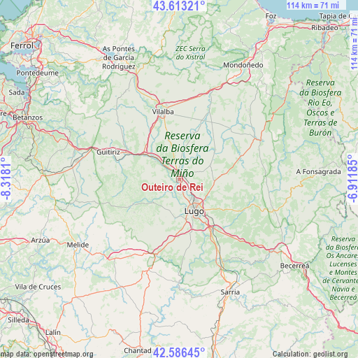
Outeiro de Rei GPS coordinates[2]
43° 6' 7.128" North, 7° 36' 53.892" West
| Map corner | latitude | longitude |
|---|---|---|
| Upper-left | 43.61321°, | -8.3181° |
| Center: | 43.10198°, | -7.61497° |
| Lower-right: | 42.58645°, | -6.91185° |
| Map W x H: | 114.2×114.2 km | = 71×71mi |
| max Lat: | 43.74134° ⇑4.7% North |
| Outeiro de Rei: | 43.10198° |
| min Lat: | ⇓95.3% South 27.64134° |
| min Long | Outeiro de Rei | max Long |
| -18.00367° | -7.61497° | 4.2899° |
| W 4.4%⇐ | ⇒95.6% E |
Elevation
Elevation of Outeiro de Rei is 413 m = 1355 ft, and this is 185 m = 607 ft below average elevation for this country.
| Max E: |
1682 m = 5518 ft | 68.2% |
| Avg. | 598 m = 1962 ft | |
| Outeiro de Rei | 413 m = 1355 ft | |
Min E: |
0 m = 0 ft | 31.8% |
See also: Spain elevation on elevation.city.
Geographical zone
Outeiro de Rei is located in North temperate zone (between Tropic of Cancer and the Arctic Circle). Distance of this Northern Tropic circle is 2186.6 km =1358.7 mi to South.| Distance of | km | miles | from Outeiro de Rei |
|---|---|---|---|
| North Pole | 5214.6 | 3240.2 | to North |
| Arctic Circle | 2608.7 | 1621 | to North |
| Tropic Cancer | 2186.6 | 1358.7 | to South |
| Equator | 4792.5 | 2977.9 | to South |


Nearby cities:
15 places around Outeiro de Rei: (largest is in red/bold)
• Begonte
8 km =5 mi,  313°
313°
• Castro de Rei
21.1 km =13.1 mi,  55°
55°
• Castroverde
24.9 km =15.5 mi,  108°
108°
• Corgo
23 km =14.3 mi,  139°
139°
• Friol
16.6 km =10.3 mi,  242°
242°
• Guitiriz
24.5 km =15.2 mi,  291°
291°
• Guntín
24.7 km =15.3 mi,  194°
194°
• Lugo
11.3 km =7 mi,  154°
154°
• Meira
28.9 km =18 mi, 64°
• Mos
8 km =5 mi,  40°
40°
• Ourol
25.8 km =16 mi,  179°
179°
• Outeiro
26.6 km =16.5 mi,  79°
79°
• Pol
23.7 km =14.7 mi, 77°
• Rábade
1.7 km =1.1 mi,  353°
353°
• Vilalba
22.5 km =14 mi, 346°
Sources, notices
• [Note1] Compared only with cities in Spain existing in our database
• [Src1] Map data: © OpenStreetMap contributors (CC-BY-SA)
• [Src2] Other city data from geonames.org with taken over terms of usage.
• [Src3] Geographical zone / Annual Mean Temperature by Robert A. Rohde @ Wikipedia
