Unzué geodata
Unzué (Navarre) is a seat of a third-order administrative division; located in Spain in Europe/Madrid (GMT+2) time zone. With population of 143 people, there are 5475 cities with bigger population in this country. Compared to other cities in Spain, 90.7% of cities are located further ↓South; 71.7% of cities are located further ←West and 50.2% of cities have higher elevation than Unzué. Note1


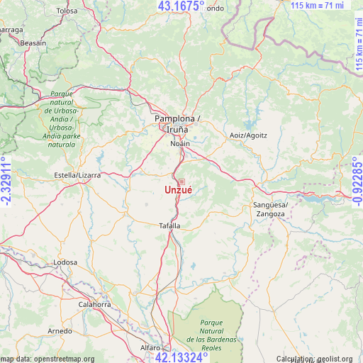
Unzué GPS coordinates[2]
42° 39' 9.072" North, 1° 37' 33.528" West
| Map corner | latitude | longitude |
|---|---|---|
| Upper-left | 43.1675°, | -2.32911° |
| Center: | 42.65252°, | -1.62598° |
| Lower-right: | 42.13324°, | -0.92285° |
| Map W x H: | 115×115 km | = 71.5×71.5mi |
| max Lat: | 43.74134° ⇑9.3% North |
| Unzué: | 42.65252° |
| min Lat: | ⇓90.7% South 27.64134° |
| min Long | Unzué | max Long |
| -18.00367° | -1.62598° | 4.2899° |
| W 71.7%⇐ | ⇒28.3% E |
Elevation
Elevation of Unzué is 655 m = 2149 ft, and this is 57 m = 187 ft above average elevation for this country.
| Max E: |
1682 m = 5518 ft | 50.2% |
| Unzué | 655 m 2149 ft | |
| Avg. | 598 m = 1962 ft | |
Min E: |
0 m = 0 ft | 49.8% |
See also: Spain elevation on elevation.city.
Geographical zone
Unzué is located in North temperate zone (between Tropic of Cancer and the Arctic Circle). Distance of this Northern Tropic circle is 2136.6 km =1327.6 mi to South.| Distance of | km | miles | from Unzué |
|---|---|---|---|
| North Pole | 5264.5 | 3271.2 | to North |
| Arctic Circle | 2658.7 | 1652 | to North |
| Tropic Cancer | 2136.6 | 1327.6 | to South |
| Equator | 4742.5 | 2946.9 | to South |


Nearby cities:
15 places around Unzué: (largest is in red/bold)
• Adiós
9.7 km =6 mi,  292°
292°
• Artajona
13.4 km =8.3 mi,  238°
238°
• Añorbe
7.3 km =4.5 mi,  274°
274°
• Barásoain
5.7 km =3.5 mi,  197°
197°
• Beriáin
9.1 km =5.7 mi,  350°
350°
• Elorz
10.3 km =6.4 mi,  30°
30°
• Enériz
8.6 km =5.3 mi,  283°
283°
• Garínoain
6 km =3.7 mi,  194°
194°
• Monreal
11.2 km =7 mi,  59°
59°
• Muruzábal
12.5 km =7.8 mi, 289°
• Olóriz
2.2 km =1.4 mi,  150°
150°
• Orísoain
6 km =3.7 mi,  162°
162°
• Pueyo
9.9 km =6.2 mi, 190°
• Tirapu
6.3 km =3.9 mi, 274°
• Uterga
12.7 km =7.9 mi,  300°
300°
Sources, notices
• [Note1] Compared only with cities in Spain existing in our database
• [Src1] Map data: © OpenStreetMap contributors (CC-BY-SA)
• [Src2] Other city data from geonames.org with taken over terms of usage.
• [Src3] Geographical zone / Annual Mean Temperature by Robert A. Rohde @ Wikipedia
