Dozón geodata
Dozón (Galicia) is a seat of a third-order administrative division; located in Spain in Europe/Madrid (GMT+2) time zone. With population of 2,041 people, there are 2135 cities with bigger population in this country. Compared to other cities in Spain, 89.1% of cities are located further ↓South; 96.4% of cities are located further →East and 56.8% of cities have lower elevation than Dozón. Note1


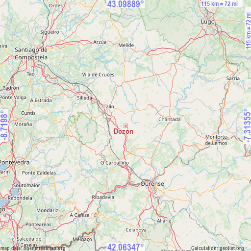
Dozón GPS coordinates[2]
42° 34' 59.988" North, 8° 1' 0.012" West
| Map corner | latitude | longitude |
|---|---|---|
| Upper-left | 43.09889°, | -8.7198° |
| Center: | 42.58333°, | -8.01667° |
| Lower-right: | 42.06347°, | -7.31355° |
| Map W x H: | 115.1×115.1 km | = 71.5×71.5mi |
| max Lat: | 43.74134° ⇑10.9% North |
| Dozón: | 42.58333° |
| min Lat: | ⇓89.1% South 27.64134° |
| min Long | Dozón | max Long |
| -18.00367° | -8.01667° | 4.2899° |
| W 3.6%⇐ | ⇒96.4% E |
Elevation
Elevation of Dozón is 722 m = 2369 ft, and this is 124 m = 407 ft above average elevation for this country.
| Max E: |
1682 m = 5518 ft | 43.2% |
| Dozón | 722 m 2369 ft | |
| Avg. | 598 m = 1962 ft | |
Min E: |
0 m = 0 ft | 56.8% |
See also: Spain elevation on elevation.city.
Geographical zone
Dozón is located in North temperate zone (between Tropic of Cancer and the Arctic Circle). Distance of this Northern Tropic circle is 2128.9 km =1322.8 mi to South.| Distance of | km | miles | from Dozón |
|---|---|---|---|
| North Pole | 5272.2 | 3276 | to North |
| Arctic Circle | 2666.4 | 1656.8 | to North |
| Tropic Cancer | 2128.9 | 1322.8 | to South |
| Equator | 4734.8 | 2942.1 | to South |


Nearby cities:
15 places around Dozón: (largest is in red/bold)
• Amoeiro
19.3 km =12 mi,  163°
163°
• Boborás
19.7 km =12.2 mi,  212°
212°
• Carballedo
16.9 km =10.5 mi,  113°
113°
• Cea
12.3 km =7.6 mi,  168°
168°
• Chantada
20.3 km =12.6 mi,  81°
81°
• Lalín
11.7 km =7.3 mi,  317°
317°
• Maside
19.3 km =12 mi,  182°
182°
• O Carballiño
17.6 km =10.9 mi,  196°
196°
• Piñor
9.2 km =5.7 mi, 172°
• Punxín
23.6 km =14.7 mi, 178°
• Rodeiro
9.1 km =5.7 mi,  33°
33°
• San Amaro
23.8 km =14.8 mi,  191°
191°
• Silleda
22.6 km =14 mi,  303°
303°
• Taboada
20.4 km =12.7 mi,  50°
50°
• Vilamarín
16.7 km =10.4 mi,  142°
142°
Sources, notices
• [Note1] Compared only with cities in Spain existing in our database
• [Src1] Map data: © OpenStreetMap contributors (CC-BY-SA)
• [Src2] Other city data from geonames.org with taken over terms of usage.
• [Src3] Geographical zone / Annual Mean Temperature by Robert A. Rohde @ Wikipedia
