Mīzan Teferī geodata
Mīzan Teferī (SNNPR) is a populated place; located in Ethiopia in Africa/Addis_Ababa (GMT+3) time zone. With population of 14,002 people, there are 80 cities with bigger population in this country. Compared to other cities in Ethiopia, 80.4% of cities are located further ↑North; 92.5% of cities are located further →East and 85% of cities have higher elevation than Mīzan Teferī. Note1


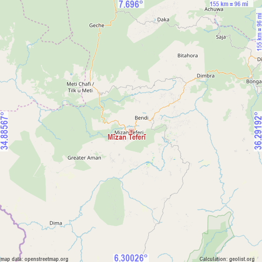
Mīzan Teferī GPS coordinates[2]
6° 59' 55.14" North, 35° 35' 19.644" East
| Map corner | latitude | longitude |
|---|---|---|
| Upper-left | 7.696°, | 34.88567° |
| Center: | 6.99865°, | 35.58879° |
| Lower-right: | 6.30026°, | 36.29192° |
| Map W x H: | 155.2×155.2 km | = 96.4×96.4mi |
| max Lat: | 14.277° ⇑80.4% North |
| Mīzan Teferī: | 6.99865° |
| min Lat: | ⇓19.6% South 4.05° |
| min Long | Mīzan Teferī | max Long |
| 34.53333° | 35.58879° | 42.8° |
| W 7.5%⇐ | ⇒92.5% E |
Elevation
Elevation of Mīzan Teferī is 1419 m = 4656 ft, and this is 476.6 m = 1564 ft below average elevation for this country.
| Max E: |
2854 m = 9364 ft | 85% |
| Avg. | 1895.6 m = 6219 ft | |
| Mīzan Teferī | 1419 m = 4656 ft | |
Min E: |
367 m = 1204 ft | 15% |
See also: Ethiopia elevation on elevation.city.
Geographical zone
Mīzan Teferī is located in North Torrid zone (between Equator and Tropic of Cancer). Distance of Equator is 778.2 km =483.6 mi to South.| Distance of | km | miles | from Mīzan Teferī |
|---|---|---|---|
| North Pole | 9228.9 | 5734.6 | to North |
| Arctic Circle | 6623 | 4115.3 | to North |
| Tropic Cancer | 1827.7 | 1135.7 | to North |
| Equator | 778.2 | 483.6 | to South |


Nearby cities:
15 places around Mīzan Teferī: (largest is in red/bold)
• Arba Minch
241.8 km =150.2 mi,  116°
116°
• Bako
173 km =107.5 mi,  141°
141°
• Bedelē
182.6 km =113.5 mi,  27°
27°
• Bonga
77.8 km =48.3 mi,  66°
66°
• Dembī Dolo
191.5 km =119 mi,  333°
333°
• Felege Neway
162.7 km =101.1 mi, 118°
• Gambēla
177.9 km =110.5 mi,  321°
321°
• Gorē
128.2 km =79.7 mi,  357°
357°
• Jimma
156.5 km =97.2 mi,  61°
61°
• Jinka
190.4 km =118.3 mi, 141°
• Metu
144.7 km =89.9 mi, 359°
• Sodo
240.3 km =149.3 mi,  93°
93°
• Tippi
27.1 km =16.8 mi, 325°
• Āgaro
150.5 km =93.5 mi,  51°
51°
• Āreka
233.1 km =144.8 mi, 88°
Sources, notices
• [Note1] Compared only with cities in Ethiopia existing in our database
• [Src1] Map data: © OpenStreetMap contributors (CC-BY-SA)
• [Src2] Other city data from geonames.org with taken over terms of usage.
• [Src3] Geographical zone / Annual Mean Temperature by Robert A. Rohde @ Wikipedia
