Arba Minch geodata
Arba Minch (SNNPR) is a populated place; located in Ethiopia in Africa/Addis_Ababa (GMT+3) time zone. With population of 69,622 people, there are 15 cities with bigger population in this country. Compared to other cities in Ethiopia, 89.7% of cities are located further ↑North; 73.8% of cities are located further →East and 88.8% of cities have higher elevation than Arba Minch. Note1


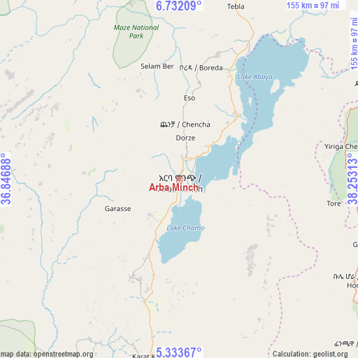
Arba Minch GPS coordinates[2]
6° 1' 59.988" North, 37° 33' 0" East
| Map corner | latitude | longitude |
|---|---|---|
| Upper-left | 6.73209°, | 36.84688° |
| Center: | 6.03333°, | 37.55° |
| Lower-right: | 5.33367°, | 38.25313° |
| Map W x H: | 155.5×155.5 km | = 96.6×96.6mi |
| max Lat: | 14.277° ⇑89.7% North |
| Arba Minch: | 6.03333° |
| min Lat: | ⇓10.3% South 4.05° |
| min Long | Arba Minch | max Long |
| 34.53333° | 37.55° | 42.8° |
| W 26.2%⇐ | ⇒73.8% E |
Elevation
Elevation of Arba Minch is 1269 m = 4163 ft, and this is 626.6 m = 2056 ft below average elevation for this country.
| Max E: |
2854 m = 9364 ft | 88.8% |
| Avg. | 1895.6 m = 6219 ft | |
| Arba Minch | 1269 m = 4163 ft | |
Min E: |
367 m = 1204 ft | 11.2% |
See also: Arba Minch elevation on elevation.city.
Geographical zone
Arba Minch is located in North Torrid zone (between Equator and Tropic of Cancer). Distance of Equator is 670.8 km =416.8 mi to South.| Distance of | km | miles | from Arba Minch |
|---|---|---|---|
| North Pole | 9336.2 | 5801.2 | to North |
| Arctic Circle | 6730.3 | 4182 | to North |
| Tropic Cancer | 1935.1 | 1202.4 | to North |
| Equator | 670.8 | 416.8 | to South |


Nearby cities:
15 places around Arba Minch: (largest is in red/bold)
• Bako
112.3 km =69.8 mi,  255°
255°
• Bodītī
109.5 km =68 mi,  18°
18°
• Dīla
94.9 km =59 mi,  63°
63°
• Felege Neway
79.4 km =49.3 mi,  291°
291°
• Gīdolē
47.2 km =29.3 mi,  205°
205°
• Hagere Maryam
87.9 km =54.6 mi,  120°
120°
• Hāgere Selam
118 km =73.3 mi, 64°
• Jinka
108.3 km =67.3 mi,  246°
246°
• Konso
87.4 km =54.3 mi,  184°
184°
• Leku
135.9 km =84.4 mi,  46°
46°
• Sodo
94.8 km =58.9 mi,  14°
14°
• Wendo
114.6 km =71.2 mi, 56°
• Yabēlo
140.8 km =87.5 mi,  155°
155°
• Yirga ‘Alem
124.6 km =77.4 mi, 50°
• Āreka
116.1 km =72.1 mi, 8°
Sources, notices
• [Note1] Compared only with cities in Ethiopia existing in our database
• [Src1] Map data: © OpenStreetMap contributors (CC-BY-SA)
• [Src2] Other city data from geonames.org with taken over terms of usage.
• [Src3] Geographical zone / Annual Mean Temperature by Robert A. Rohde @ Wikipedia
