Sodo geodata
Sodo (SNNPR) is a populated place; located in Ethiopia in Africa/Addis_Ababa (GMT+3) time zone. With population of 86,050 people, there are 12 cities with bigger population in this country. Compared to other cities in Ethiopia, 84.1% of cities are located further ↑North; 70.1% of cities are located further →East and 61.7% of cities have lower elevation than Sodo. Note1


Sodo GPS coordinates[2]
6° 51' 36" North, 37° 45' 41.724" East
| Map corner | latitude | longitude |
|---|---|---|
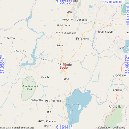
| Upper-left | 7.55756°, | 37.05847° |
| Center: | 6.86°, | 37.76159° |
| Lower-right: | 6.16141°, | 38.46472° |
| Map W x H: | 155.2×155.2 km | = 96.4×96.4mi |
| max Lat: | 14.277° ⇑84.1% North |
| Sodo: | 6.86° |
| min Lat: | ⇓15.9% South 4.05° |
| min Long | Sodo | max Long |
| 34.53333° | 37.76159° | 42.8° |
| W 29.9%⇐ | ⇒70.1% E |
Elevation
Elevation of Sodo is 2045 m = 6709 ft, and this is 149.4 m = 490 ft above average elevation for this country.
| Max E: |
2854 m = 9364 ft | 38.3% |
| Sodo | 2045 m 6709 ft | |
| Avg. | 1895.6 m = 6219 ft | |
Min E: |
367 m = 1204 ft | 61.7% |
See also: Sodo elevation on elevation.city.
Geographical zone
Sodo is located in North Torrid zone (between Equator and Tropic of Cancer). Distance of Equator is 762.8 km =474 mi to South.| Distance of | km | miles | from Sodo |
|---|---|---|---|
| North Pole | 9244.3 | 5744.1 | to North |
| Arctic Circle | 6638.4 | 4124.9 | to North |
| Tropic Cancer | 1843.2 | 1145.3 | to North |
| Equator | 762.8 | 474 | to South |


Nearby cities:
15 places around Sodo: (largest is in red/bold)
• Arba Minch
94.8 km =58.9 mi,  194°
194°
• Bodītī
16.6 km =10.3 mi,  44°
44°
• Dīla
78.7 km =48.9 mi,  128°
128°
• Felege Neway
115.3 km =71.6 mi,  237°
237°
• Hawassa
82 km =51 mi,  74°
74°
• Hosa’ina
77.4 km =48.1 mi,  7°
7°
• Hāgere Selam
93.3 km =58 mi,  116°
116°
• Jimma
136.5 km =84.8 mi,  311°
311°
• Kofelē
115.1 km =71.5 mi,  78°
78°
• K’olīto
62 km =38.5 mi,  34°
34°
• Leku
75.4 km =46.9 mi,  88°
88°
• Shashemenē
99.9 km =62.1 mi, 67°
• Wendo
77.9 km =48.4 mi,  111°
111°
• Yirga ‘Alem
73.4 km =45.6 mi,  99°
99°
• Āreka
24 km =14.9 mi,  343°
343°
Sources, notices
• [Note1] Compared only with cities in Ethiopia existing in our database
• [Src1] Map data: © OpenStreetMap contributors (CC-BY-SA)
• [Src2] Other city data from geonames.org with taken over terms of usage.
• [Src3] Geographical zone / Annual Mean Temperature by Robert A. Rohde @ Wikipedia
