Lobuni geodata
Lobuni (SNNPR) is a populated place; located in Ethiopia in Africa/Addis_Ababa (GMT+3) time zone. With population of 3,363 people, there are 105 cities with bigger population in this country. Compared to other cities in Ethiopia, 99.1% of cities are located further ↑North; 90.7% of cities are located further →East and 100% of cities have higher elevation than Lobuni. Note1


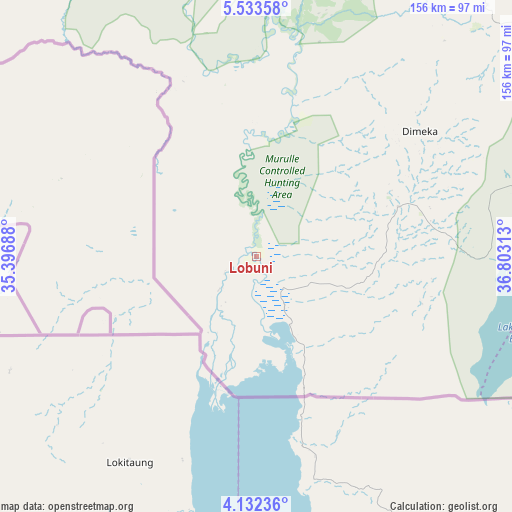
Lobuni GPS coordinates[2]
4° 49' 59.988" North, 36° 6' 0" East
| Map corner | latitude | longitude |
|---|---|---|
| Upper-left | 5.53358°, | 35.39688° |
| Center: | 4.83333°, | 36.1° |
| Lower-right: | 4.13236°, | 36.80313° |
| Map W x H: | 155.8×155.8 km | = 96.8×96.8mi |
| max Lat: | 14.277° ⇑99.1% North |
| Lobuni: | 4.83333° |
| min Lat: | ⇓0.9% South 4.05° |
| min Long | Lobuni | max Long |
| 34.53333° | 36.1° | 42.8° |
| W 9.3%⇐ | ⇒90.7% E |
Elevation
Elevation of Lobuni is 367 m = 1204 ft, and this is 1528.6 m = 5015 ft below average elevation for this country.
| Max E: |
2854 m = 9364 ft | 100% |
| Avg. | 1895.6 m = 6219 ft | |
| Lobuni | 367 m = 1204 ft | |
Min E: |
367 m = 1204 ft | 0% |
See also: Ethiopia elevation on elevation.city.
Geographical zone
Lobuni is located in North Torrid zone (between Equator and Tropic of Cancer). Distance of Equator is 537.4 km =333.9 mi to South.| Distance of | km | miles | from Lobuni |
|---|---|---|---|
| North Pole | 9469.6 | 5884.1 | to North |
| Arctic Circle | 6863.8 | 4265 | to North |
| Tropic Cancer | 2068.5 | 1285.3 | to North |
| Equator | 537.4 | 333.9 | to South |


Nearby cities:
15 places around Lobuni: (largest is in red/bold)
• Arba Minch
208.7 km =129.7 mi,  50°
50°
• Bako
117.6 km =73.1 mi,  26°
26°
• Bonga
272.8 km =169.5 mi,  3°
3°
• Dīla
301.9 km =187.6 mi, 54°
• Felege Neway
184.7 km =114.8 mi, 27°
• Gīdolē
167.1 km =103.8 mi,  57°
57°
• Hagere Maryam
252.7 km =157 mi,  69°
69°
• Jinka
109.3 km =67.9 mi, 33°
• Konso
160.1 km =99.5 mi, 73°
• Mēga
259 km =160.9 mi,  109°
109°
• Mīzan Teferī
247.3 km =153.7 mi,  346°
346°
• Sodo
290.8 km =180.7 mi,  39°
39°
• Tippi
272.8 km =169.5 mi,  344°
344°
• Turmi
45 km =28 mi, 70°
• Yabēlo
219.8 km =136.6 mi,  88°
88°
Sources, notices
• [Note1] Compared only with cities in Ethiopia existing in our database
• [Src1] Map data: © OpenStreetMap contributors (CC-BY-SA)
• [Src2] Other city data from geonames.org with taken over terms of usage.
• [Src3] Geographical zone / Annual Mean Temperature by Robert A. Rohde @ Wikipedia
