Hagere Maryam geodata
Hagere Maryam (Oromiya) is a populated place; located in Ethiopia in Africa/Addis_Ababa (GMT+3) time zone. With population of 22,105 people, there are 61 cities with bigger population in this country. Compared to other cities in Ethiopia, 95.3% of cities are located further ↑North; 56.1% of cities are located further →East and 54.2% of cities have higher elevation than Hagere Maryam. Note1


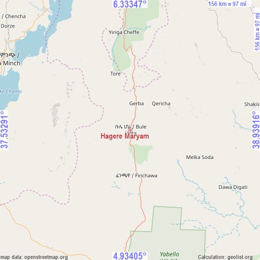
Hagere Maryam GPS coordinates[2]
5° 38' 3.048" North, 38° 14' 9.708" East
| Map corner | latitude | longitude |
|---|---|---|
| Upper-left | 6.33347°, | 37.53291° |
| Center: | 5.63418°, | 38.23603° |
| Lower-right: | 4.93405°, | 38.93916° |
| Map W x H: | 155.6×155.6 km | = 96.7×96.7mi |
| max Lat: | 14.277° ⇑95.3% North |
| Hagere Maryam: | 5.63418° |
| min Lat: | ⇓4.7% South 4.05° |
| min Long | Hagere Maryam | max Long |
| 34.53333° | 38.23603° | 42.8° |
| W 43.9%⇐ | ⇒56.1% E |
Elevation
Elevation of Hagere Maryam is 1883 m = 6178 ft, and this is 12.6 m = 41 ft below average elevation for this country.
| Max E: |
2854 m = 9364 ft | 54.2% |
| Avg. | 1895.6 m = 6219 ft | |
| Hagere Maryam | 1883 m = 6178 ft | |
Min E: |
367 m = 1204 ft | 45.8% |
See also: Ethiopia elevation on elevation.city.
Geographical zone
Hagere Maryam is located in North Torrid zone (between Equator and Tropic of Cancer). Distance of Equator is 626.5 km =389.3 mi to South.| Distance of | km | miles | from Hagere Maryam |
|---|---|---|---|
| North Pole | 9380.6 | 5828.8 | to North |
| Arctic Circle | 6774.7 | 4209.6 | to North |
| Tropic Cancer | 1979.5 | 1230 | to North |
| Equator | 626.5 | 389.3 | to South |


Nearby cities:
15 places around Hagere Maryam: (largest is in red/bold)
• Arba Minch
87.9 km =54.6 mi,  300°
300°
• Bodītī
153.7 km =95.5 mi,  344°
344°
• Dīla
87.5 km =54.4 mi,  5°
5°
• Felege Neway
166.9 km =103.7 mi, 296°
• Gīdolē
96.2 km =59.8 mi,  271°
271°
• Hawassa
161 km =100 mi, 9°
• Hāgere Selam
99.4 km =61.8 mi,  18°
18°
• Kibre Mengist
87.2 km =54.2 mi,  71°
71°
• Konso
93.6 km =58.2 mi,  242°
242°
• Leku
139.7 km =86.8 mi, 9°
• Shakiso
76 km =47.2 mi,  78°
78°
• Sodo
146 km =90.7 mi, 338°
• Wendo
109.2 km =67.9 mi, 10°
• Yabēlo
85.2 km =52.9 mi,  191°
191°
• Yirga ‘Alem
125.7 km =78.1 mi, 9°
Sources, notices
• [Note1] Compared only with cities in Ethiopia existing in our database
• [Src1] Map data: © OpenStreetMap contributors (CC-BY-SA)
• [Src2] Other city data from geonames.org with taken over terms of usage.
• [Src3] Geographical zone / Annual Mean Temperature by Robert A. Rohde @ Wikipedia
