Mēga geodata
Mēga (Oromiya) is a populated place; located in Ethiopia in Africa/Addis_Ababa (GMT+3) time zone. With population of 6,884 people, there are 102 cities with bigger population in this country. Compared to other cities in Ethiopia, 100% of cities are located further ↑North; 54.2% of cities are located further →East and 57% of cities have higher elevation than Mēga. Note1


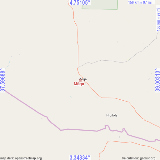
Mēga GPS coordinates[2]
4° 3' 0" North, 38° 18' 0" East
| Map corner | latitude | longitude |
|---|---|---|
| Upper-left | 4.75105°, | 37.59688° |
| Center: | 4.05°, | 38.3° |
| Lower-right: | 3.34834°, | 39.00313° |
| Map W x H: | 156×156 km | = 96.9×96.9mi |
| max Lat: | 14.277° ⇑100% North |
| Mēga: | 4.05° |
| min Lat: | ⇓0% South 4.05° |
| min Long | Mēga | max Long |
| 34.53333° | 38.3° | 42.8° |
| W 45.8%⇐ | ⇒54.2% E |
Elevation
Elevation of Mēga is 1819 m = 5968 ft, and this is 76.6 m = 251 ft below average elevation for this country.
| Max E: |
2854 m = 9364 ft | 57% |
| Avg. | 1895.6 m = 6219 ft | |
| Mēga | 1819 m = 5968 ft | |
Min E: |
367 m = 1204 ft | 43% |
See also: Ethiopia elevation on elevation.city.
Geographical zone
Mēga is located in North Torrid zone (between Equator and Tropic of Cancer). Distance of Equator is 450.3 km =279.8 mi to South.| Distance of | km | miles | from Mēga |
|---|---|---|---|
| North Pole | 9556.7 | 5938.3 | to North |
| Arctic Circle | 6950.9 | 4319.1 | to North |
| Tropic Cancer | 2155.6 | 1339.4 | to North |
| Equator | 450.3 | 279.8 | to South |


Nearby cities:
15 places around Mēga: (largest is in red/bold)
• Arba Minch
235.7 km =146.5 mi,  339°
339°
• Bako
272.1 km =169.1 mi,  315°
315°
• Dīla
263.2 km =163.5 mi,  0°
0°
• Felege Neway
295.3 km =183.5 mi,  327°
327°
• Gīdolē
205.8 km =127.9 mi, 329°
• Hagere Maryam
176.3 km =109.5 mi,  357°
357°
• Hāgere Selam
271.6 km =168.8 mi,  5°
5°
• Jinka
255.1 km =158.5 mi,  314°
314°
• Kibre Mengist
217.4 km =135.1 mi,  20°
20°
• Konso
161.2 km =100.2 mi, 325°
• Lobuni
259 km =160.9 mi,  289°
289°
• Shakiso
202.3 km =125.7 mi, 19°
• Turmi
225.7 km =140.2 mi,  296°
296°
• Wendo
283.8 km =176.3 mi, 2°
• Yabēlo
95.7 km =59.5 mi,  345°
345°
Sources, notices
• [Note1] Compared only with cities in Ethiopia existing in our database
• [Src1] Map data: © OpenStreetMap contributors (CC-BY-SA)
• [Src2] Other city data from geonames.org with taken over terms of usage.
• [Src3] Geographical zone / Annual Mean Temperature by Robert A. Rohde @ Wikipedia
