Hāgere Hiywet geodata
Hāgere Hiywet (Oromiya) is a populated place; located in Ethiopia in Africa/Addis_Ababa (GMT+3) time zone. With population of 43,920 people, there are 23 cities with bigger population in this country. Compared to other cities in Ethiopia, 50.5% of cities are located further ↓South; 67.3% of cities are located further →East and 66.4% of cities have lower elevation than Hāgere Hiywet. Note1


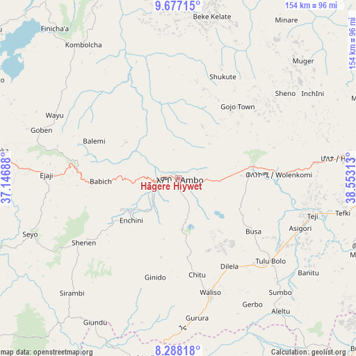
Hāgere Hiywet GPS coordinates[2]
8° 58' 59.988" North, 37° 51' 0" East
| Map corner | latitude | longitude |
|---|---|---|
| Upper-left | 9.67715°, | 37.14688° |
| Center: | 8.98333°, | 37.85° |
| Lower-right: | 8.28818°, | 38.55313° |
| Map W x H: | 154.4×154.4 km | = 95.9×95.9mi |
| max Lat: | 14.277° ⇑49.5% North |
| Hāgere Hiywet: | 8.98333° |
| min Lat: | ⇓50.5% South 4.05° |
| min Long | Hāgere Hiywet | max Long |
| 34.53333° | 37.85° | 42.8° |
| W 32.7%⇐ | ⇒67.3% E |
Elevation
Elevation of Hāgere Hiywet is 2089 m = 6854 ft, and this is 193.4 m = 635 ft above average elevation for this country.
| Max E: |
2854 m = 9364 ft | 33.6% |
| Hāgere Hiywet | 2089 m 6854 ft | |
| Avg. | 1895.6 m = 6219 ft | |
Min E: |
367 m = 1204 ft | 66.4% |
See also: Hāgere Hiywet elevation on elevation.city.
Geographical zone
Hāgere Hiywet is located in North Torrid zone (between Equator and Tropic of Cancer). Distance of Equator is 998.9 km =620.7 mi to South.| Distance of | km | miles | from Hāgere Hiywet |
|---|---|---|---|
| North Pole | 9008.2 | 5597.4 | to North |
| Arctic Circle | 6402.3 | 3978.2 | to North |
| Tropic Cancer | 1607.1 | 998.6 | to North |
| Equator | 998.9 | 620.7 | to South |


Nearby cities:
15 places around Hāgere Hiywet: (largest is in red/bold)
• Addis Ababa
98.6 km =61.3 mi,  87°
87°
• Bishoftu
126.6 km =78.7 mi,  101°
101°
• Butajīra
111.9 km =69.5 mi,  149°
149°
• Dejen
135.2 km =84 mi,  13°
13°
• Fichē
132.8 km =82.5 mi,  46°
46°
• Gebre Guracha
109 km =67.7 mi,  33°
33°
• Genet
72 km =44.7 mi,  82°
82°
• Gēdo
44.1 km =27.4 mi,  274°
274°
• Mojo
146.5 km =91 mi,  107°
107°
• Sebeta
84.5 km =52.5 mi, 95°
• Sendafa
130.2 km =80.9 mi, 81°
• Shambu
104.8 km =65.1 mi,  308°
308°
• Tulu Bolo
53.5 km =33.2 mi,  131°
131°
• Waliso
51.5 km =32 mi,  165°
165°
• Ādīs ‘Alem
60.7 km =37.7 mi, 84°
Sources, notices
• [Note1] Compared only with cities in Ethiopia existing in our database
• [Src1] Map data: © OpenStreetMap contributors (CC-BY-SA)
• [Src2] Other city data from geonames.org with taken over terms of usage.
• [Src3] Geographical zone / Annual Mean Temperature by Robert A. Rohde @ Wikipedia
