Gebre Guracha geodata
Gebre Guracha (Oromiya) is a populated place; located in Ethiopia in Africa/Addis_Ababa (GMT+3) time zone. With population of 16,583 people, there are 75 cities with bigger population in this country. Compared to other cities in Ethiopia, 66.4% of cities are located further ↓South; 51.4% of cities are located further →East and 87.9% of cities have lower elevation than Gebre Guracha. Note1


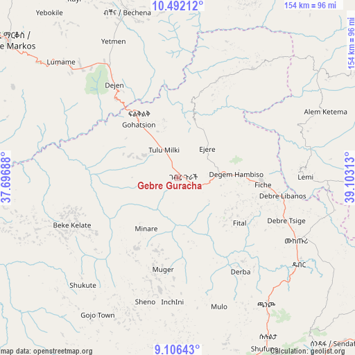
Gebre Guracha GPS coordinates[2]
9° 48' 0" North, 38° 24' 0" East
| Map corner | latitude | longitude |
|---|---|---|
| Upper-left | 10.49212°, | 37.69688° |
| Center: | 9.8°, | 38.4° |
| Lower-right: | 9.10643°, | 39.10313° |
| Map W x H: | 154.1×154.1 km | = 95.8×95.8mi |
| max Lat: | 14.277° ⇑33.6% North |
| Gebre Guracha: | 9.8° |
| min Lat: | ⇓66.4% South 4.05° |
| min Long | Gebre Guracha | max Long |
| 34.53333° | 38.4° | 42.8° |
| W 48.6%⇐ | ⇒51.4% E |
Elevation
Elevation of Gebre Guracha is 2539 m = 8330 ft, and this is 643.4 m = 2111 ft above average elevation for this country.
| Max E: |
2854 m = 9364 ft | 12.1% |
| Gebre Guracha | 2539 m 8330 ft | |
| Avg. | 1895.6 m = 6219 ft | |
Min E: |
367 m = 1204 ft | 87.9% |
See also: Ethiopia elevation on elevation.city.
Geographical zone
Gebre Guracha is located in North Torrid zone (between Equator and Tropic of Cancer). Distance of Equator is 1089.7 km =677.1 mi to South.| Distance of | km | miles | from Gebre Guracha |
|---|---|---|---|
| North Pole | 8917.4 | 5541 | to North |
| Arctic Circle | 6311.5 | 3921.8 | to North |
| Tropic Cancer | 1516.3 | 942.2 | to North |
| Equator | 1089.7 | 677.1 | to South |


Nearby cities:
15 places around Gebre Guracha: (largest is in red/bold)
• Addis Ababa
94.2 km =58.5 mi,  156°
156°
• Bichena
75.5 km =46.9 mi,  343°
343°
• Bishoftu
132.7 km =82.5 mi,  151°
151°
• Debre Birhan
124.8 km =77.5 mi,  96°
96°
• Debre Mark’os
95.2 km =59.2 mi,  309°
309°
• Debre Werk’
99.7 km =62 mi,  345°
345°
• Dejen
50.1 km =31.1 mi,  324°
324°
• Fichē
36.5 km =22.7 mi,  90°
90°
• Genet
82.3 km =51.1 mi,  172°
172°
• Gēdo
135.8 km =84.4 mi,  230°
230°
• Hāgere Hiywet
109 km =67.7 mi,  213°
213°
• Sebeta
101.1 km =62.8 mi, 166°
• Sendafa
99.3 km =61.7 mi,  136°
136°
• Tulu Bolo
127.6 km =79.3 mi,  189°
189°
• Ādīs ‘Alem
85.2 km =52.9 mi,  180°
180°
Sources, notices
• [Note1] Compared only with cities in Ethiopia existing in our database
• [Src1] Map data: © OpenStreetMap contributors (CC-BY-SA)
• [Src2] Other city data from geonames.org with taken over terms of usage.
• [Src3] Geographical zone / Annual Mean Temperature by Robert A. Rohde @ Wikipedia
