Gēdo geodata
Gēdo (Oromiya) is a populated place; located in Ethiopia in Africa/Addis_Ababa (GMT+3) time zone. With population of 7,499 people, there are 100 cities with bigger population in this country. Compared to other cities in Ethiopia, 52.3% of cities are located further ↓South; 77.6% of cities are located further →East and 86% of cities have lower elevation than Gēdo. Note1


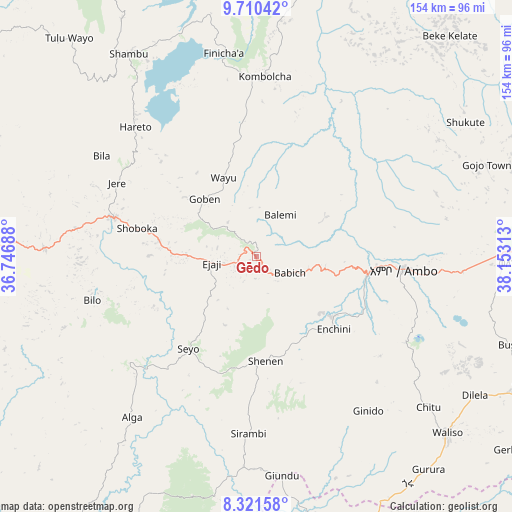
Gēdo GPS coordinates[2]
9° 1' 0.012" North, 37° 27' 0" East
| Map corner | latitude | longitude |
|---|---|---|
| Upper-left | 9.71042°, | 36.74688° |
| Center: | 9.01667°, | 37.45° |
| Lower-right: | 8.32158°, | 38.15313° |
| Map W x H: | 154.4×154.4 km | = 95.9×95.9mi |
| max Lat: | 14.277° ⇑47.7% North |
| Gēdo: | 9.01667° |
| min Lat: | ⇓52.3% South 4.05° |
| min Long | Gēdo | max Long |
| 34.53333° | 37.45° | 42.8° |
| W 22.4%⇐ | ⇒77.6% E |
Elevation
Elevation of Gēdo is 2500 m = 8202 ft, and this is 604.4 m = 1983 ft above average elevation for this country.
| Max E: |
2854 m = 9364 ft | 14% |
| Gēdo | 2500 m 8202 ft | |
| Avg. | 1895.6 m = 6219 ft | |
Min E: |
367 m = 1204 ft | 86% |
See also: Ethiopia elevation on elevation.city.
Geographical zone
Gēdo is located in North Torrid zone (between Equator and Tropic of Cancer). Distance of Equator is 1002.6 km =623 mi to South.| Distance of | km | miles | from Gēdo |
|---|---|---|---|
| North Pole | 9004.5 | 5595.1 | to North |
| Arctic Circle | 6398.6 | 3975.9 | to North |
| Tropic Cancer | 1603.4 | 996.3 | to North |
| Equator | 1002.6 | 623 | to South |


Nearby cities:
15 places around Gēdo: (largest is in red/bold)
• Addis Ababa
142.4 km =88.5 mi,  89°
89°
• Bedelē
135.7 km =84.3 mi,  242°
242°
• Butajīra
142 km =88.2 mi,  134°
134°
• Debre Mark’os
151.5 km =94.1 mi,  11°
11°
• Dejen
148.2 km =92.1 mi,  30°
30°
• Gebre Guracha
135.8 km =84.4 mi,  50°
50°
• Genet
115.4 km =71.7 mi, 87°
• Hāgere Hiywet
44.1 km =27.4 mi, 94°
• Jimma
164 km =101.9 mi,  204°
204°
• Sebeta
128.6 km =79.9 mi, 94°
• Shambu
72.2 km =44.9 mi,  327°
327°
• Tulu Bolo
92.8 km =57.7 mi,  114°
114°
• Waliso
78 km =48.5 mi, 133°
• Ādīs ‘Alem
104.3 km =64.8 mi, 88°
• Āgaro
156.7 km =97.4 mi,  214°
214°
Sources, notices
• [Note1] Compared only with cities in Ethiopia existing in our database
• [Src1] Map data: © OpenStreetMap contributors (CC-BY-SA)
• [Src2] Other city data from geonames.org with taken over terms of usage.
• [Src3] Geographical zone / Annual Mean Temperature by Robert A. Rohde @ Wikipedia
