Shambu geodata
Shambu (Oromiya) is a populated place; located in Ethiopia in Africa/Addis_Ababa (GMT+3) time zone. With population of 15,354 people, there are 78 cities with bigger population in this country. Compared to other cities in Ethiopia, 63.6% of cities are located further ↓South; 81.3% of cities are located further →East and 90.7% of cities have lower elevation than Shambu. Note1


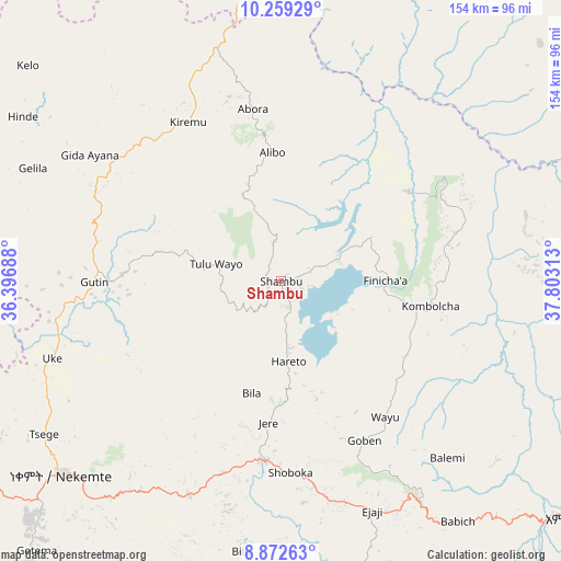
Shambu GPS coordinates[2]
9° 34' 0.012" North, 37° 6' 0" East
| Map corner | latitude | longitude |
|---|---|---|
| Upper-left | 10.25929°, | 36.39688° |
| Center: | 9.56667°, | 37.1° |
| Lower-right: | 8.87263°, | 37.80313° |
| Map W x H: | 154.2×154.2 km | = 95.8×95.8mi |
| max Lat: | 14.277° ⇑36.4% North |
| Shambu: | 9.56667° |
| min Lat: | ⇓63.6% South 4.05° |
| min Long | Shambu | max Long |
| 34.53333° | 37.1° | 42.8° |
| W 18.7%⇐ | ⇒81.3% E |
Elevation
Elevation of Shambu is 2576 m = 8451 ft, and this is 680.4 m = 2232 ft above average elevation for this country.
| Max E: |
2854 m = 9364 ft | 9.3% |
| Shambu | 2576 m 8451 ft | |
| Avg. | 1895.6 m = 6219 ft | |
Min E: |
367 m = 1204 ft | 90.7% |
See also: Ethiopia elevation on elevation.city.
Geographical zone
Shambu is located in North Torrid zone (between Equator and Tropic of Cancer). Distance of Equator is 1063.7 km =661 mi to South.| Distance of | km | miles | from Shambu |
|---|---|---|---|
| North Pole | 8943.3 | 5557.1 | to North |
| Arctic Circle | 6337.5 | 3937.9 | to North |
| Tropic Cancer | 1542.2 | 958.3 | to North |
| Equator | 1063.7 | 661 | to South |


Nearby cities:
15 places around Shambu: (largest is in red/bold)
• Bedelē
148.3 km =92.1 mi,  213°
213°
• Bichena
155.4 km =96.6 mi,  50°
50°
• Burē
126.1 km =78.4 mi,  358°
358°
• Debre Mark’os
111.3 km =69.2 mi,  38°
38°
• Debre Werk’
169.1 km =105.1 mi, 43°
• Dejen
131.4 km =81.6 mi,  59°
59°
• Finote Selam
127.3 km =79.1 mi,  8°
8°
• Gebre Guracha
144.8 km =90 mi,  79°
79°
• Genet
163.4 km =101.5 mi,  109°
109°
• Gimbi
145.6 km =90.5 mi,  252°
252°
• Gēdo
72.2 km =44.9 mi,  147°
147°
• Hāgere Hiywet
104.8 km =65.1 mi,  128°
128°
• Tulu Bolo
158.2 km =98.3 mi, 129°
• Waliso
149 km =92.6 mi,  140°
140°
• Ādīs ‘Alem
154.5 km =96 mi, 112°
Sources, notices
• [Note1] Compared only with cities in Ethiopia existing in our database
• [Src1] Map data: © OpenStreetMap contributors (CC-BY-SA)
• [Src2] Other city data from geonames.org with taken over terms of usage.
• [Src3] Geographical zone / Annual Mean Temperature by Robert A. Rohde @ Wikipedia
