Debre Mark’os geodata
Debre Mark’os (Amhara) is a populated place; located in Ethiopia in Africa/Addis_Ababa (GMT+3) time zone. With population of 59,920 people, there are 17 cities with bigger population in this country. Compared to other cities in Ethiopia, 73.8% of cities are located further ↓South; 71% of cities are located further →East and 83.2% of cities have lower elevation than Debre Mark’os. Note1


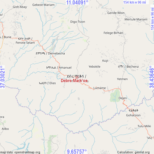
Debre Mark’os GPS coordinates[2]
10° 21' 0" North, 37° 43' 59.988" East
| Map corner | latitude | longitude |
|---|---|---|
| Upper-left | 11.04091°, | 37.03021° |
| Center: | 10.35°, | 37.73333° |
| Lower-right: | 9.65757°, | 38.43646° |
| Map W x H: | 153.8×153.8 km | = 95.6×95.6mi |
| max Lat: | 14.277° ⇑26.2% North |
| Debre Mark’os: | 10.35° |
| min Lat: | ⇓73.8% South 4.05° |
| min Long | Debre Mark’os | max Long |
| 34.53333° | 37.73333° | 42.8° |
| W 29%⇐ | ⇒71% E |
Elevation
Elevation of Debre Mark’os is 2487 m = 8159 ft, and this is 591.4 m = 1940 ft above average elevation for this country.
| Max E: |
2854 m = 9364 ft | 16.8% |
| Debre Mark’os | 2487 m 8159 ft | |
| Avg. | 1895.6 m = 6219 ft | |
Min E: |
367 m = 1204 ft | 83.2% |
See also: Debre Mark’os elevation on elevation.city.
Geographical zone
Debre Mark’os is located in North Torrid zone (between Equator and Tropic of Cancer). Distance of Equator is 1150.8 km =715.1 mi to South.| Distance of | km | miles | from Debre Mark’os |
|---|---|---|---|
| North Pole | 8856.2 | 5503 | to North |
| Arctic Circle | 6250.4 | 3883.8 | to North |
| Tropic Cancer | 1455.1 | 904.2 | to North |
| Equator | 1150.8 | 715.1 | to South |


Nearby cities:
15 places around Debre Mark’os: (largest is in red/bold)
• Addiet Canna
105.5 km =65.6 mi,  345°
345°
• Bahir Dar
143.2 km =89 mi,  344°
344°
• Bichena
52.2 km =32.4 mi,  77°
77°
• Burē
82.6 km =51.3 mi,  298°
298°
• Debre Tabor
169.6 km =105.4 mi,  10°
10°
• Debre Werk’
59 km =36.7 mi,  53°
53°
• Dejen
48.3 km =30 mi,  114°
114°
• Fichē
125.4 km =77.9 mi,  119°
119°
• Finote Selam
64.2 km =39.9 mi,  307°
307°
• Gebre Guracha
95.2 km =59.2 mi,  129°
129°
• Genet
165.6 km =102.9 mi,  149°
149°
• Gēdo
151.5 km =94.1 mi,  191°
191°
• Hāgere Hiywet
152.5 km =94.8 mi,  175°
175°
• Shambu
111.3 km =69.2 mi,  218°
218°
• Ādīs ‘Alem
163.6 km =101.7 mi, 153°
Sources, notices
• [Note1] Compared only with cities in Ethiopia existing in our database
• [Src1] Map data: © OpenStreetMap contributors (CC-BY-SA)
• [Src2] Other city data from geonames.org with taken over terms of usage.
• [Src3] Geographical zone / Annual Mean Temperature by Robert A. Rohde @ Wikipedia
