Simiane-la-Rotonde geodata
Simiane-la-Rotonde (Provence-Alpes-Côte d'Azur) is a populated place; located in France in Europe/Paris (GMT+2) time zone. With population of 568 people, there are 13863 cities with bigger population in this country. Compared to other cities in France, 87.2% of cities are located further ↑North; 83.4% of cities are located further ←West and 96.4% of cities have lower elevation than Simiane-la-Rotonde. Note1
Administrative division(s):
- Level 1: Provence-Alpes-Côte d'Azur
- Level 2: Alpes-de-Haute-Provence
- Level 3: Arrondissement de Forcalquier
- Level 4: Simiane-la-Rotonde


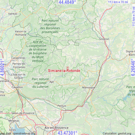
Simiane-la-Rotonde GPS coordinates[2]
43° 58' 51.996" North, 5° 33' 47.988" East
| Map corner | latitude | longitude |
|---|---|---|
| Upper-left | 44.4849°, | 4.86021° |
| Center: | 43.98111°, | 5.56333° |
| Lower-right: | 43.47301°, | 6.26646° |
| Map W x H: | 112.5×112.5 km | = 69.9×69.9mi |
| max Lat: | 51.07786° ⇑87.2% North |
| Simiane-la-Rotonde: | 43.98111° |
| min Lat: | ⇓12.8% South 41.3874° |
| min Long | Simiane-la-Roto | max Long |
| -5.08615° | 5.56333° | 9.52242° |
| W 83.4%⇐ | ⇒16.6% E |
Elevation
Elevation of Simiane-la-Rotonde is 677 m = 2221 ft, and this is 483.3 m = 1586 ft above average elevation for this country.
| Max E: |
2333 m = 7654 ft | 3.6% |
| Simiane-la-Rotonde | 677 m 2221 ft | |
| Avg. | 193.7 m = 635 ft | |
Min E: |
-1 m = -3 ft | 96.4% |
See also: France elevation on elevation.city.
Geographical zone
Simiane-la-Rotonde is located in North temperate zone (between Tropic of Cancer and the Arctic Circle). Distance of this Northern Tropic circle is 2284.3 km =1419.4 mi to South.| Distance of | km | miles | from Simiane-la-Rotonde |
|---|---|---|---|
| North Pole | 5116.8 | 3179.4 | to North |
| Arctic Circle | 2510.9 | 1560.2 | to North |
| Tropic Cancer | 2284.3 | 1419.4 | to South |
| Equator | 4890.2 | 3038.6 | to South |


Nearby cities:
15 places around Simiane-la-Rotonde: (largest is in red/bold)
• Banon
8.2 km =5.1 mi,  39°
39°
• Céreste
14.1 km =8.8 mi,  172°
172°
• Forcalquier
17.5 km =10.9 mi,  97°
97°
• Mane
17 km =10.6 mi,  106°
106°
• Reillanne
13.7 km =8.5 mi,  145°
145°
• Revest-du-Bion
11.4 km =7.1 mi,  353°
353°
• Rustrel
8.9 km =5.5 mi,  224°
224°
• Saignon
17 km =10.6 mi, 219°
• Saint-Christol
7.8 km =4.8 mi,  313°
313°
• Saint-Martin-de-Castillon
14.1 km =8.8 mi,  197°
197°
• Saint-Michel-l’Observatoire
14.6 km =9.1 mi,  123°
123°
• Saint-Saturnin-lès-Apt
15.4 km =9.6 mi,  249°
249°
• Sault
17.3 km =10.7 mi, 314°
• Viens
9.6 km =6 mi,  179°
179°
• Villars
14.1 km =8.8 mi,  242°
242°
Sources, notices
• [Note1] Compared only with cities in France existing in our database
• [Src1] Map data: © OpenStreetMap contributors (CC-BY-SA)
• [Src2] Other city data from geonames.org with taken over terms of usage.
• [Src3] Geographical zone / Annual Mean Temperature by Robert A. Rohde @ Wikipedia
