La Chapelle-sur-Erdre geodata
La Chapelle-sur-Erdre (Pays de la Loire) is a populated place; located in France in Europe/Paris (GMT+2) time zone. With population of 18,481 people, there are 511 cities with bigger population in this country. Compared to other cities in France, 51.5% of cities are located further ↑North; 92.6% of cities are located further →East and 86.7% of cities have higher elevation than La Chapelle-sur-Erdre. Note1
Administrative division(s):
- Level 1: Pays de la Loire
- Level 2: Loire-Atlantique
- Level 3: Arrondissement de Nantes
- Level 4: La Chapelle-sur-Erdre
Current local time in La Chapelle-sur-Erdre:
07:06 PM, SaturdayDifference from your time zone: hours


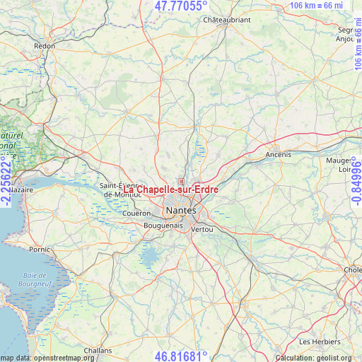
La Chapelle-sur-Erdre GPS coordinates[2]
47° 17' 44.988" North, 1° 33' 11.124" West
| Map corner | latitude | longitude |
|---|---|---|
| Upper-left | 47.77055°, | -2.25622° |
| Center: | 47.29583°, | -1.55309° |
| Lower-right: | 46.81681°, | -0.84996° |
| Map W x H: | 106×106 km | = 65.9×65.9mi |
| max Lat: | 51.07786° ⇑51.5% North |
| La Chapelle-sur-Erdre: | 47.29583° |
| min Lat: | ⇓48.5% South 41.3874° |
| min Long | La Chapelle-sur | max Long |
| -5.08615° | -1.55309° | 9.52242° |
| W 7.4%⇐ | ⇒92.6% E |
Elevation
Elevation of La Chapelle-sur-Erdre is 38 m = 125 ft, and this is 155.7 m = 511 ft below average elevation for this country.
| Max E: |
2333 m = 7654 ft | 86.7% |
| Avg. | 193.7 m = 635 ft | |
| La Chapelle-sur-Erdre | 38 m = 125 ft | |
Min E: |
-1 m = -3 ft | 13.3% |
See also: France elevation on elevation.city.
Geographical zone
La Chapelle-sur-Erdre is located in North temperate zone (between Tropic of Cancer and the Arctic Circle). Distance of this North polar circle is 2142.4 km =1331.2 mi to North.| Distance of | km | miles | from La Chapelle-sur-Erdre |
|---|---|---|---|
| North Pole | 4748.3 | 2950.5 | to North |
| Arctic Circle | 2142.4 | 1331.2 | to North |
| Tropic Cancer | 2652.9 | 1648.4 | to South |
| Equator | 5258.8 | 3267.7 | to South |


Nearby cities:
15 places around La Chapelle-sur-Erdre: (largest is in red/bold)
• Basse-Goulaine
11.4 km =7.1 mi,  145°
145°
• Carquefou
4.7 km =2.9 mi,  86°
86°
• Casson
10.2 km =6.3 mi,  358°
358°
• Mauves-sur-Loire
12.5 km =7.8 mi, 89°
• Nantes
8.7 km =5.4 mi,  180°
180°
• Orvault
5.9 km =3.7 mi,  241°
241°
• Petit-Mars
13.4 km =8.3 mi,  34°
34°
• Rezé
12.7 km =7.9 mi, 178°
• Saint-Herblain
11.3 km =7 mi,  219°
219°
• Saint-Sébastien-sur-Loire
10.5 km =6.5 mi,  159°
159°
• Sainte-Luce-sur-Loire
7 km =4.3 mi,  131°
131°
• Sautron
9.6 km =6 mi,  247°
247°
• Sucé-sur-Erdre
4.4 km =2.7 mi,  19°
19°
• Thouaré-sur-Loire
9.2 km =5.7 mi,  109°
109°
• Treillières
6.3 km =3.9 mi,  307°
307°
Sources, notices
• [Note1] Compared only with cities in France existing in our database
• [Src1] Map data: © OpenStreetMap contributors (CC-BY-SA)
• [Src2] Other city data from geonames.org with taken over terms of usage.
• [Src3] Geographical zone / Annual Mean Temperature by Robert A. Rohde @ Wikipedia
