Saint-Urcize geodata
Saint-Urcize (Auvergne-Rhône-Alpes) is a populated place; located in France in Europe/Paris (GMT+2) time zone. With population of 531 people, there are 14589 cities with bigger population in this country. Compared to other cities in France, 82.1% of cities are located further ↑North; 57.9% of cities are located further ←West and 99.5% of cities have lower elevation than Saint-Urcize. Note1
Administrative division(s):
- Level 1: Auvergne-Rhône-Alpes
- Level 2: Cantal
- Level 3: Arrondissement de Saint-Flour
- Level 4: Saint-Urcize


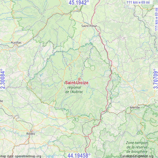
Saint-Urcize GPS coordinates[2]
44° 41' 47.58" North, 3° 0' 14.256" East
| Map corner | latitude | longitude |
|---|---|---|
| Upper-left | 45.1942°, | 2.30084° |
| Center: | 44.69655°, | 3.00396° |
| Lower-right: | 44.19458°, | 3.70709° |
| Map W x H: | 111.1×111.1 km | = 69×69mi |
| max Lat: | 51.07786° ⇑82.1% North |
| Saint-Urcize: | 44.69655° |
| min Lat: | ⇓17.9% South 41.3874° |
| min Long | Saint-Urcize | max Long |
| -5.08615° | 3.00396° | 9.52242° |
| W 57.9%⇐ | ⇒42.1% E |
Elevation
Elevation of Saint-Urcize is 1120 m = 3675 ft, and this is 926.3 m = 3039 ft above average elevation for this country.
| Max E: |
2333 m = 7654 ft | 0.5% |
| Saint-Urcize | 1120 m 3675 ft | |
| Avg. | 193.7 m = 635 ft | |
Min E: |
-1 m = -3 ft | 99.5% |
See also: France elevation on elevation.city.
Geographical zone
Saint-Urcize is located in North temperate zone (between Tropic of Cancer and the Arctic Circle). Distance of this Northern Tropic circle is 2363.9 km =1468.9 mi to South.| Distance of | km | miles | from Saint-Urcize |
|---|---|---|---|
| North Pole | 5037.3 | 3130 | to North |
| Arctic Circle | 2431.4 | 1510.8 | to North |
| Tropic Cancer | 2363.9 | 1468.9 | to South |
| Equator | 4969.8 | 3088.1 | to South |


Nearby cities:
15 places around Saint-Urcize: (largest is in red/bold)
• Aumont-Aubrac
22.4 km =13.9 mi,  82°
82°
• Castelnau-de-Mandailles
19.8 km =12.3 mi,  208°
208°
• Chaudes-Aigues
17.6 km =10.9 mi,  0°
0°
• Coubisou
27 km =16.8 mi,  233°
233°
• Espalion
27.2 km =16.9 mi,  224°
224°
• Laguiole
12.5 km =7.8 mi,  263°
263°
• Marvejols
27.7 km =17.2 mi,  124°
124°
• Montpeyroux
15.5 km =9.6 mi,  246°
246°
• Nasbinals
5.1 km =3.2 mi,  138°
138°
• Neuvéglise
25.8 km =16 mi,  356°
356°
• Rimeize
26.4 km =16.4 mi,  73°
73°
• Saint-Amans-des-Cots
27.1 km =16.8 mi,  267°
267°
• Saint-Chély-d’Apcher
24.6 km =15.3 mi,  60°
60°
• Saint-Geniez-d’Olt
25.8 km =16 mi,  185°
185°
• Sainte-Geneviève-sur-Argence
22.6 km =14 mi,  301°
301°
Sources, notices
• [Note1] Compared only with cities in France existing in our database
• [Src1] Map data: © OpenStreetMap contributors (CC-BY-SA)
• [Src2] Other city data from geonames.org with taken over terms of usage.
• [Src3] Geographical zone / Annual Mean Temperature by Robert A. Rohde @ Wikipedia
