Arvieu geodata
Arvieu (Occitanie) is a populated place; located in France in Europe/Paris (GMT+2) time zone. With population of 933 people, there are 9360 cities with bigger population in this country. Compared to other cities in France, 85.6% of cities are located further ↑North; 52.9% of cities are located further ←West and 96.8% of cities have lower elevation than Arvieu. Note1
Administrative division(s):
- Level 1: Occitanie
- Level 2: Département de l'Aveyron
- Level 3: Arrondissement de Millau
- Level 4: Arvieu


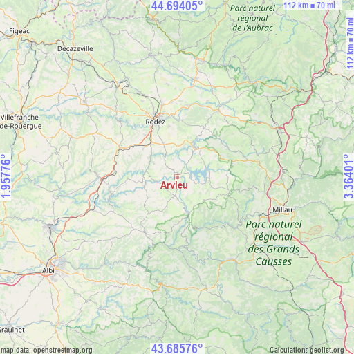
Arvieu GPS coordinates[2]
44° 11' 31.416" North, 2° 39' 39.204" East
| Map corner | latitude | longitude |
|---|---|---|
| Upper-left | 44.69405°, | 1.95776° |
| Center: | 44.19206°, | 2.66089° |
| Lower-right: | 43.68576°, | 3.36401° |
| Map W x H: | 112.1×112.1 km | = 69.7×69.7mi |
| max Lat: | 51.07786° ⇑85.6% North |
| Arvieu: | 44.19206° |
| min Lat: | ⇓14.4% South 41.3874° |
| min Long | Arvieu | max Long |
| -5.08615° | 2.66089° | 9.52242° |
| W 52.9%⇐ | ⇒47.1% E |
Elevation
Elevation of Arvieu is 706 m = 2316 ft, and this is 512.3 m = 1681 ft above average elevation for this country.
| Max E: |
2333 m = 7654 ft | 3.2% |
| Arvieu | 706 m 2316 ft | |
| Avg. | 193.7 m = 635 ft | |
Min E: |
-1 m = -3 ft | 96.8% |
See also: France elevation on elevation.city.
Geographical zone
Arvieu is located in North temperate zone (between Tropic of Cancer and the Arctic Circle). Distance of this Northern Tropic circle is 2307.8 km =1434 mi to South.| Distance of | km | miles | from Arvieu |
|---|---|---|---|
| North Pole | 5093.4 | 3164.9 | to North |
| Arctic Circle | 2487.5 | 1545.7 | to North |
| Tropic Cancer | 2307.8 | 1434 | to South |
| Equator | 4913.7 | 3053.2 | to South |


Nearby cities:
15 places around Arvieu: (largest is in red/bold)
• Calmont
13.4 km =8.3 mi,  298°
298°
• Cassagnes-Bégonhès
10.7 km =6.6 mi,  256°
256°
• Durenque
9.8 km =6.1 mi,  200°
200°
• Flavin
11.6 km =7.2 mi,  337°
337°
• La Selve
13.1 km =8.1 mi,  227°
227°
• Le Monastère
17.8 km =11.1 mi, 338°
• Luc-la-Primaube
16.9 km =10.5 mi,  323°
323°
• Manhac
16.8 km =10.4 mi,  294°
294°
• Pont-de-Salars
11.2 km =7 mi,  28°
28°
• Sainte-Radegonde
16.4 km =10.2 mi,  350°
350°
• Salles-Curan
10.2 km =6.3 mi,  96°
96°
• Salmiech
7.1 km =4.4 mi, 260°
• Ségur
17.8 km =11.1 mi,  51°
51°
• Trémouilles
6 km =3.7 mi, 347°
• Villefranche-de-Panat
12 km =7.5 mi,  162°
162°
Sources, notices
• [Note1] Compared only with cities in France existing in our database
• [Src1] Map data: © OpenStreetMap contributors (CC-BY-SA)
• [Src2] Other city data from geonames.org with taken over terms of usage.
• [Src3] Geographical zone / Annual Mean Temperature by Robert A. Rohde @ Wikipedia
