Lombez geodata
Lombez (Occitanie) is a populated place; located in France in Europe/Paris (GMT+2) time zone. With population of 1,451 people, there are 6376 cities with bigger population in this country. Compared to other cities in France, 93.4% of cities are located further ↑North; 69.6% of cities are located further →East and 61% of cities have lower elevation than Lombez. Note1


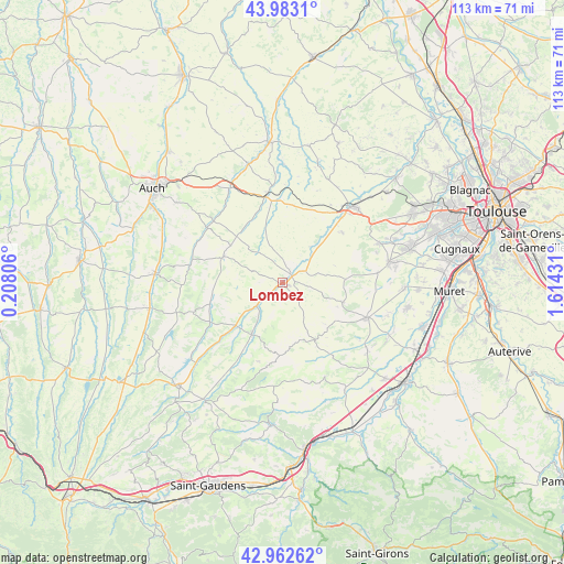
Lombez GPS coordinates[2]
43° 28' 30.036" North, 0° 54' 40.284" East
| Map corner | latitude | longitude |
|---|---|---|
| Upper-left | 43.9831°, | 0.20806° |
| Center: | 43.47501°, | 0.91119° |
| Lower-right: | 42.96262°, | 1.61431° |
| Map W x H: | 113.5×113.5 km | = 70.5×70.5mi |
| max Lat: | 51.07786° ⇑93.4% North |
| Lombez: | 43.47501° |
| min Lat: | ⇓6.6% South 41.3874° |
| min Long | Lombez | max Long |
| -5.08615° | 0.91119° | 9.52242° |
| W 30.4%⇐ | ⇒69.6% E |
Elevation
Elevation of Lombez is 175 m = 574 ft, and this is 18.7 m = 61 ft below average elevation for this country.
| Max E: |
2333 m = 7654 ft | 39% |
| Avg. | 193.7 m = 635 ft | |
| Lombez | 175 m = 574 ft | |
Min E: |
-1 m = -3 ft | 61% |
See also: France elevation on elevation.city.
Geographical zone
Lombez is located in North temperate zone (between Tropic of Cancer and the Arctic Circle). Distance of this Northern Tropic circle is 2228 km =1384.4 mi to South.| Distance of | km | miles | from Lombez |
|---|---|---|---|
| North Pole | 5173.1 | 3214.4 | to North |
| Arctic Circle | 2567.2 | 1595.2 | to North |
| Tropic Cancer | 2228 | 1384.4 | to South |
| Equator | 4834 | 3003.7 | to South |


Nearby cities:
15 places around Lombez: (largest is in red/bold)
• Auradé
15.6 km =9.7 mi,  49°
49°
• Bonrepos-sur-Aussonnelle
20.7 km =12.9 mi,  67°
67°
• Endoufielle
11.9 km =7.4 mi, 45°
• Escornebœuf
19.5 km =12.1 mi,  357°
357°
• Gimont
17 km =10.6 mi,  350°
350°
• L’Isle-Jourdain
20.6 km =12.8 mi,  42°
42°
• L’Isle-en-Dodon
11.8 km =7.3 mi,  211°
211°
• Monferran-Savès
14.8 km =9.2 mi,  22°
22°
• Rieumes
18.1 km =11.2 mi,  113°
113°
• Saiguède
19.7 km =12.2 mi, 72°
• Saint-Thomas
14.4 km =8.9 mi, 72°
• Sainte-Foy-de-Peyrolières
18.9 km =11.7 mi,  84°
84°
• Samatan
2.5 km =1.6 mi, 37°
• Saramon
13.1 km =8.1 mi,  294°
294°
• Simorre
14.5 km =9 mi,  259°
259°
Sources, notices
• [Note1] Compared only with cities in France existing in our database
• [Src1] Map data: © OpenStreetMap contributors (CC-BY-SA)
• [Src2] Other city data from geonames.org with taken over terms of usage.
• [Src3] Geographical zone / Annual Mean Temperature by Robert A. Rohde @ Wikipedia
