Foëcy geodata
Foëcy (Centre) is a populated place; located in France in Europe/Paris (GMT+2) time zone. With population of 2,053 people, there are 4676 cities with bigger population in this country. Compared to other cities in France, 53.3% of cities are located further ↑North; 55% of cities are located further →East and 55.2% of cities have higher elevation than Foëcy. Note1
Administrative division(s):
- Level 1: Centre
- Level 2: Cher
- Level 3: Arrondissement de Vierzon
- Level 4: Foëcy


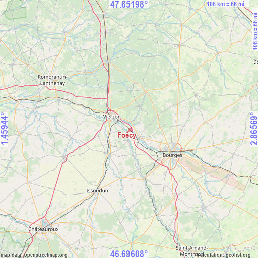
Foëcy GPS coordinates[2]
47° 10' 34.248" North, 2° 9' 45.252" East
| Map corner | latitude | longitude |
|---|---|---|
| Upper-left | 47.65198°, | 1.45944° |
| Center: | 47.17618°, | 2.16257° |
| Lower-right: | 46.69608°, | 2.86569° |
| Map W x H: | 106.3×106.3 km | = 66.1×66.1mi |
| max Lat: | 51.07786° ⇑53.3% North |
| Foëcy: | 47.17618° |
| min Lat: | ⇓46.7% South 41.3874° |
| min Long | Foëcy | max Long |
| -5.08615° | 2.16257° | 9.52242° |
| W 45%⇐ | ⇒55% E |
Elevation
Elevation of Foëcy is 116 m = 381 ft, and this is 77.7 m = 255 ft below average elevation for this country.
| Max E: |
2333 m = 7654 ft | 55.2% |
| Avg. | 193.7 m = 635 ft | |
| Foëcy | 116 m = 381 ft | |
Min E: |
-1 m = -3 ft | 44.8% |
See also: France elevation on elevation.city.
Geographical zone
Foëcy is located in North temperate zone (between Tropic of Cancer and the Arctic Circle). Distance of this North polar circle is 2155.7 km =1339.5 mi to North.| Distance of | km | miles | from Foëcy |
|---|---|---|---|
| North Pole | 4761.6 | 2958.7 | to North |
| Arctic Circle | 2155.7 | 1339.5 | to North |
| Tropic Cancer | 2639.6 | 1640.2 | to South |
| Equator | 5245.5 | 3259.4 | to South |


Nearby cities:
15 places around Foëcy: (largest is in red/bold)
• Allogny
13.1 km =8.1 mi,  65°
65°
• Allouis
5.1 km =3.2 mi,  103°
103°
• Berry-Bouy
12.1 km =7.5 mi,  127°
127°
• Lury-sur-Arnon
9.6 km =6 mi,  235°
235°
• Marmagne
12.5 km =7.8 mi, 132°
• Massay
13 km =8.1 mi,  258°
258°
• Mehun-sur-Yèvre
5.6 km =3.5 mi,  139°
139°
• Méreau
8.6 km =5.3 mi, 260°
• Quincy
4.8 km =3 mi,  184°
184°
• Reuilly
13.6 km =8.5 mi,  221°
221°
• Saint-Hilaire-de-Court
11.3 km =7 mi,  286°
286°
• Saint-Éloy-de-Gy
13.8 km =8.6 mi, 99°
• Vierzon
8.7 km =5.4 mi,  305°
305°
• Vignoux-sur-Barangeon
2.8 km =1.7 mi,  15°
15°
• Vouzeron
10.3 km =6.4 mi,  25°
25°
Sources, notices
• [Note1] Compared only with cities in France existing in our database
• [Src1] Map data: © OpenStreetMap contributors (CC-BY-SA)
• [Src2] Other city data from geonames.org with taken over terms of usage.
• [Src3] Geographical zone / Annual Mean Temperature by Robert A. Rohde @ Wikipedia
