Carsan geodata
Carsan (Occitanie) is a populated place; located in France in Europe/Paris (GMT+2) time zone. With population of 637 people, there are 12716 cities with bigger population in this country. Compared to other cities in France, 85.3% of cities are located further ↑North; 72.7% of cities are located further ←West and 63.3% of cities have lower elevation than Carsan. Note1
Administrative division(s):
- Level 1: Occitanie
- Level 2: Gard
- Level 3: Arrondissement de Nîmes
- Level 4: Carsan


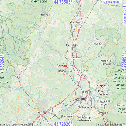
Carsan GPS coordinates[2]
44° 14' 3.12" North, 4° 35' 44.772" East
| Map corner | latitude | longitude |
|---|---|---|
| Upper-left | 44.73583°, | 3.89264° |
| Center: | 44.2342°, | 4.59577° |
| Lower-right: | 43.72826°, | 5.29889° |
| Map W x H: | 112×112 km | = 69.6×69.6mi |
| max Lat: | 51.07786° ⇑85.3% North |
| Carsan: | 44.2342° |
| min Lat: | ⇓14.7% South 41.3874° |
| min Long | Carsan | max Long |
| -5.08615° | 4.59577° | 9.52242° |
| W 72.7%⇐ | ⇒27.3% E |
Elevation
Elevation of Carsan is 186 m = 610 ft, and this is 7.7 m = 25 ft below average elevation for this country.
| Max E: |
2333 m = 7654 ft | 36.7% |
| Avg. | 193.7 m = 635 ft | |
| Carsan | 186 m = 610 ft | |
Min E: |
-1 m = -3 ft | 63.3% |
See also: France elevation on elevation.city.
Geographical zone
Carsan is located in North temperate zone (between Tropic of Cancer and the Arctic Circle). Distance of this Northern Tropic circle is 2312.5 km =1436.9 mi to South.| Distance of | km | miles | from Carsan |
|---|---|---|---|
| North Pole | 5088.7 | 3162 | to North |
| Arctic Circle | 2482.8 | 1542.7 | to North |
| Tropic Cancer | 2312.5 | 1436.9 | to South |
| Equator | 4918.4 | 3056.2 | to South |


Nearby cities:
15 places around Carsan: (largest is in red/bold)
• Bagnols-sur-Cèze
8.4 km =5.2 mi,  168°
168°
• Cornillon
8.5 km =5.3 mi,  262°
262°
• Goudargues
10.5 km =6.5 mi, 257°
• Mondragon
9.3 km =5.8 mi,  87°
87°
• Pont-Saint-Esprit
4.7 km =2.9 mi,  60°
60°
• Sabran
10.1 km =6.3 mi,  202°
202°
• Saint-Alexandre
2.1 km =1.3 mi,  110°
110°
• Saint-Gervais
5.8 km =3.6 mi, 195°
• Saint-Julien-de-Peyrolas
6.5 km =4 mi,  337°
337°
• Saint-Just-d'Ardèche
7.5 km =4.7 mi,  12°
12°
• Saint-Marcel-d'Ardèche
10.5 km =6.5 mi, 9°
• Saint-Nazaire
4.6 km =2.9 mi,  150°
150°
• Saint-Paulet-de-Caisson
2.9 km =1.8 mi,  3°
3°
• Saint-Étienne-des-Sorts
10.3 km =6.4 mi,  121°
121°
• Vénéjan
6.2 km =3.9 mi,  131°
131°
Sources, notices
• [Note1] Compared only with cities in France existing in our database
• [Src1] Map data: © OpenStreetMap contributors (CC-BY-SA)
• [Src2] Other city data from geonames.org with taken over terms of usage.
• [Src3] Geographical zone / Annual Mean Temperature by Robert A. Rohde @ Wikipedia
