Boismé geodata
Boismé (Nouvelle-Aquitaine) is a populated place; located in France in Europe/Paris (GMT+2) time zone. With population of 1,123 people, there are 7991 cities with bigger population in this country. Compared to other cities in France, 57.5% of cities are located further ↑North; 82.6% of cities are located further →East and 55.3% of cities have lower elevation than Boismé. Note1
Administrative division(s):
- Level 1: Nouvelle-Aquitaine
- Level 2: Département des Deux-Sèvres
- Level 3: Arrondissement de Bressuire
- Level 4: Boismé


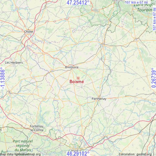
Boismé GPS coordinates[2]
46° 46' 28.992" North, 0° 26' 8.628" West
| Map corner | latitude | longitude |
|---|---|---|
| Upper-left | 47.25412°, | -1.13886° |
| Center: | 46.77472°, | -0.43573° |
| Lower-right: | 46.29102°, | 0.26739° |
| Map W x H: | 107.1×107.1 km | = 66.5×66.5mi |
| max Lat: | 51.07786° ⇑57.5% North |
| Boismé: | 46.77472° |
| min Lat: | ⇓42.5% South 41.3874° |
| min Long | Boismé | max Long |
| -5.08615° | -0.43573° | 9.52242° |
| W 17.4%⇐ | ⇒82.6% E |
Elevation
Elevation of Boismé is 151 m = 495 ft, and this is 42.7 m = 140 ft below average elevation for this country.
| Max E: |
2333 m = 7654 ft | 44.7% |
| Avg. | 193.7 m = 635 ft | |
| Boismé | 151 m = 495 ft | |
Min E: |
-1 m = -3 ft | 55.3% |
See also: France elevation on elevation.city.
Geographical zone
Boismé is located in North temperate zone (between Tropic of Cancer and the Arctic Circle). Distance of this North polar circle is 2200.3 km =1367.2 mi to North.| Distance of | km | miles | from Boismé |
|---|---|---|---|
| North Pole | 4806.2 | 2986.4 | to North |
| Arctic Circle | 2200.3 | 1367.2 | to North |
| Tropic Cancer | 2594.9 | 1612.4 | to South |
| Equator | 5200.9 | 3231.7 | to South |


Nearby cities:
15 places around Boismé: (largest is in red/bold)
• Amailloux
9.6 km =6 mi,  108°
108°
• Bressuire
8.5 km =5.3 mi,  330°
330°
• Bretignolles
16.3 km =10.1 mi,  307°
307°
• Chanteloup
6.8 km =4.2 mi,  262°
262°
• Chiché
6.3 km =3.9 mi,  66°
66°
• Clessé
6.9 km =4.3 mi,  160°
160°
• Courlay
10.1 km =6.3 mi,  272°
272°
• Faye-l’Abbesse
8.8 km =5.5 mi,  45°
45°
• La Chapelle-Saint-Laurent
4.5 km =2.8 mi,  224°
224°
• La Forêt-sur-Sèvre
16.3 km =10.1 mi, 268°
• Largeasse
10.3 km =6.4 mi,  208°
208°
• Moncoutant
12.9 km =8 mi,  244°
244°
• Moutiers-sous-Chantemerle
16.5 km =10.3 mi, 237°
• Neuvy-Bouin
11.1 km =6.9 mi,  189°
189°
• Saint-Aubin-le-Cloud
15 km =9.3 mi, 155°
Sources, notices
• [Note1] Compared only with cities in France existing in our database
• [Src1] Map data: © OpenStreetMap contributors (CC-BY-SA)
• [Src2] Other city data from geonames.org with taken over terms of usage.
• [Src3] Geographical zone / Annual Mean Temperature by Robert A. Rohde @ Wikipedia
