Beaumont-les-Autels geodata
Beaumont-les-Autels (Centre) is a populated place; located in France in Europe/Paris (GMT+2) time zone. With population of 534 people, there are 14532 cities with bigger population in this country. Compared to other cities in France, 63.8% of cities are located further ↓South; 69.1% of cities are located further →East and 78.5% of cities have lower elevation than Beaumont-les-Autels. Note1
Administrative division(s):
- Level 1: Centre
- Level 2: Département d'Eure-et-Loir
- Level 3: Arrondissement de Nogent-le-Rotrou
- Level 4: Beaumont-les-Autels


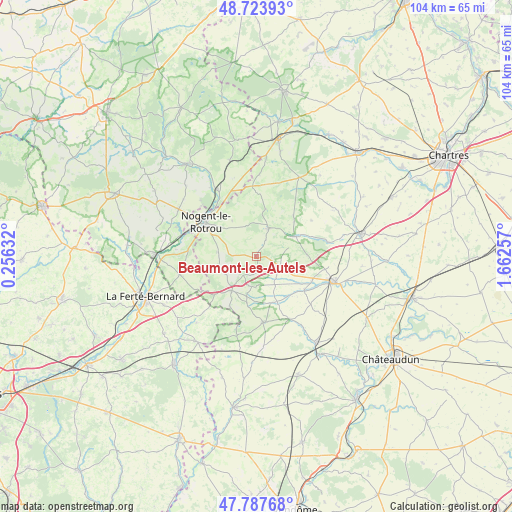
Beaumont-les-Autels GPS coordinates[2]
48° 15' 28.62" North, 0° 57' 33.984" East
| Map corner | latitude | longitude |
|---|---|---|
| Upper-left | 48.72393°, | 0.25632° |
| Center: | 48.25795°, | 0.95944° |
| Lower-right: | 47.78768°, | 1.66257° |
| Map W x H: | 104.1×104.1 km | = 64.7×64.7mi |
| max Lat: | 51.07786° ⇑36.2% North |
| Beaumont-les-Autels: | 48.25795° |
| min Lat: | ⇓63.8% South 41.3874° |
| min Long | Beaumont-les-Au | max Long |
| -5.08615° | 0.95944° | 9.52242° |
| W 30.9%⇐ | ⇒69.1% E |
Elevation
Elevation of Beaumont-les-Autels is 277 m = 909 ft, and this is 83.3 m = 273 ft above average elevation for this country.
| Max E: |
2333 m = 7654 ft | 21.5% |
| Beaumont-les-Autels | 277 m 909 ft | |
| Avg. | 193.7 m = 635 ft | |
Min E: |
-1 m = -3 ft | 78.5% |
See also: France elevation on elevation.city.
Geographical zone
Beaumont-les-Autels is located in North temperate zone (between Tropic of Cancer and the Arctic Circle). Distance of this North polar circle is 2035.4 km =1264.7 mi to North.| Distance of | km | miles | from Beaumont-les-Autels |
|---|---|---|---|
| North Pole | 4641.3 | 2884 | to North |
| Arctic Circle | 2035.4 | 1264.7 | to North |
| Tropic Cancer | 2759.9 | 1714.9 | to South |
| Equator | 5365.8 | 3334.2 | to South |


Nearby cities:
15 places around Beaumont-les-Autels: (largest is in red/bold)
• Authon-du-Perche
8.5 km =5.3 mi,  216°
216°
• Brou
15.9 km =9.9 mi,  106°
106°
• Brunelles
8.8 km =5.5 mi,  326°
326°
• Ceton
15.9 km =9.9 mi,  257°
257°
• Condé-sur-Huisne
15.9 km =9.9 mi, 329°
• Frazé
10.4 km =6.5 mi,  88°
88°
• La Bazoche-Gouet
13.2 km =8.2 mi,  172°
172°
• Margon
12.7 km =7.9 mi,  313°
313°
• Mâle
16.5 km =10.3 mi,  275°
275°
• Nogent-le-Rotrou
12.4 km =7.7 mi,  304°
304°
• Saint-Hilaire-sur-Erre
17.4 km =10.8 mi,  290°
290°
• Souancé-au-Perche
7.8 km =4.8 mi, 277°
• Thiron Gardais
6.8 km =4.2 mi,  15°
15°
• Unverre
11.9 km =7.4 mi,  124°
124°
• Yèvres
17.7 km =11 mi, 107°
Sources, notices
• [Note1] Compared only with cities in France existing in our database
• [Src1] Map data: © OpenStreetMap contributors (CC-BY-SA)
• [Src2] Other city data from geonames.org with taken over terms of usage.
• [Src3] Geographical zone / Annual Mean Temperature by Robert A. Rohde @ Wikipedia
