Authon-du-Perche geodata
Authon-du-Perche (Centre) is a populated place; located in France in Europe/Paris (GMT+2) time zone. With population of 1,268 people, there are 7192 cities with bigger population in this country. Compared to other cities in France, 62.8% of cities are located further ↓South; 69.8% of cities are located further →East and 73.7% of cities have lower elevation than Authon-du-Perche. Note1
Administrative division(s):
- Level 1: Centre
- Level 2: Département d'Eure-et-Loir
- Level 3: Arrondissement de Nogent-le-Rotrou
- Level 4: Authon-du-Perche


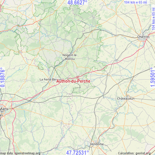
Authon-du-Perche GPS coordinates[2]
48° 11' 46.14" North, 0° 53' 30.804" East
| Map corner | latitude | longitude |
|---|---|---|
| Upper-left | 48.6627°, | 0.18876° |
| Center: | 48.19615°, | 0.89189° |
| Lower-right: | 47.72531°, | 1.59501° |
| Map W x H: | 104.2×104.2 km | = 64.7×64.7mi |
| max Lat: | 51.07786° ⇑37.2% North |
| Authon-du-Perche: | 48.19615° |
| min Lat: | ⇓62.8% South 41.3874° |
| min Long | Authon-du-Perch | max Long |
| -5.08615° | 0.89189° | 9.52242° |
| W 30.2%⇐ | ⇒69.8% E |
Elevation
Elevation of Authon-du-Perche is 240 m = 787 ft, and this is 46.3 m = 152 ft above average elevation for this country.
| Max E: |
2333 m = 7654 ft | 26.3% |
| Authon-du-Perche | 240 m 787 ft | |
| Avg. | 193.7 m = 635 ft | |
Min E: |
-1 m = -3 ft | 73.7% |
See also: France elevation on elevation.city.
Geographical zone
Authon-du-Perche is located in North temperate zone (between Tropic of Cancer and the Arctic Circle). Distance of this North polar circle is 2042.3 km =1269 mi to North.| Distance of | km | miles | from Authon-du-Perche |
|---|---|---|---|
| North Pole | 4648.2 | 2888.3 | to North |
| Arctic Circle | 2042.3 | 1269 | to North |
| Tropic Cancer | 2753 | 1710.6 | to South |
| Equator | 5358.9 | 3329.9 | to South |


Nearby cities:
15 places around Authon-du-Perche: (largest is in red/bold)
• Avezé
16.2 km =10.1 mi,  282°
282°
• Beaumont-les-Autels
8.5 km =5.3 mi,  36°
36°
• Brunelles
14.2 km =8.8 mi,  0°
0°
• Ceton
11.1 km =6.9 mi,  287°
287°
• Cherreau
15.4 km =9.6 mi,  268°
268°
• Cormes
14.2 km =8.8 mi,  257°
257°
• La Bazoche-Gouet
9.1 km =5.7 mi,  133°
133°
• Lamnay
16.3 km =10.1 mi,  237°
237°
• Margon
16.1 km =10 mi,  344°
344°
• Melleray
12.8 km =8 mi,  212°
212°
• Mâle
14.1 km =8.8 mi,  306°
306°
• Nogent-le-Rotrou
14.9 km =9.3 mi, 339°
• Souancé-au-Perche
8.3 km =5.2 mi, 340°
• Thiron Gardais
15 km =9.3 mi,  26°
26°
• Unverre
14.8 km =9.2 mi,  89°
89°
Sources, notices
• [Note1] Compared only with cities in France existing in our database
• [Src1] Map data: © OpenStreetMap contributors (CC-BY-SA)
• [Src2] Other city data from geonames.org with taken over terms of usage.
• [Src3] Geographical zone / Annual Mean Temperature by Robert A. Rohde @ Wikipedia
