Aumont-Aubrac geodata
Aumont-Aubrac (Occitanie) is a populated place; located in France in Europe/Paris (GMT+2) time zone. With population of 1,106 people, there are 8091 cities with bigger population in this country. Compared to other cities in France, 81.9% of cities are located further ↑North; 61.8% of cities are located further ←West and 99.3% of cities have lower elevation than Aumont-Aubrac. Note1
Administrative division(s):
- Level 1: Occitanie
- Level 2: Département de la Lozère
- Level 3: Arrondissement de Mende
- Level 4: Peyre en Aubrac


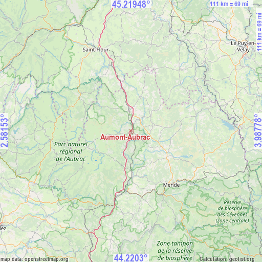
Aumont-Aubrac GPS coordinates[2]
44° 43' 19.38" North, 3° 17' 4.776" East
| Map corner | latitude | longitude |
|---|---|---|
| Upper-left | 45.21948°, | 2.58153° |
| Center: | 44.72205°, | 3.28466° |
| Lower-right: | 44.2203°, | 3.98778° |
| Map W x H: | 111.1×111.1 km | = 69×69mi |
| max Lat: | 51.07786° ⇑81.9% North |
| Aumont-Aubrac: | 44.72205° |
| min Lat: | ⇓18.1% South 41.3874° |
| min Long | Aumont-Aubrac | max Long |
| -5.08615° | 3.28466° | 9.52242° |
| W 61.8%⇐ | ⇒38.2% E |
Elevation
Elevation of Aumont-Aubrac is 1059 m = 3474 ft, and this is 865.3 m = 2839 ft above average elevation for this country.
| Max E: |
2333 m = 7654 ft | 0.7% |
| Aumont-Aubrac | 1059 m 3474 ft | |
| Avg. | 193.7 m = 635 ft | |
Min E: |
-1 m = -3 ft | 99.3% |
See also: France elevation on elevation.city.
Geographical zone
Aumont-Aubrac is located in North temperate zone (between Tropic of Cancer and the Arctic Circle). Distance of this Northern Tropic circle is 2366.7 km =1470.6 mi to South.| Distance of | km | miles | from Aumont-Aubrac |
|---|---|---|---|
| North Pole | 5034.4 | 3128.2 | to North |
| Arctic Circle | 2428.5 | 1509 | to North |
| Tropic Cancer | 2366.7 | 1470.6 | to South |
| Equator | 4972.6 | 3089.8 | to South |


Nearby cities:
15 places around Aumont-Aubrac: (largest is in red/bold)
• Barjac
26.3 km =16.3 mi,  157°
157°
• Chastel-Nouvel
25 km =15.5 mi,  136°
136°
• Chaudes-Aigues
26.6 km =16.5 mi,  303°
303°
• Chirac
22.2 km =13.8 mi,  183°
183°
• Grandrieu
28.5 km =17.7 mi,  76°
76°
• Le Malzieu-Ville
15.5 km =9.6 mi,  14°
14°
• Le Monastier-Pin-Moriès
23 km =14.3 mi,  186°
186°
• Marvejols
18.7 km =11.6 mi, 178°
• Montrodat
19.4 km =12.1 mi,  169°
169°
• Nasbinals
19.9 km =12.4 mi,  250°
250°
• Rieutort-de-Randon
18.5 km =11.5 mi,  122°
122°
• Rimeize
5.7 km =3.5 mi,  33°
33°
• Saint-Alban-sur-Limagnole
10.5 km =6.5 mi,  51°
51°
• Saint-Chély-d’Apcher
9.4 km =5.8 mi,  354°
354°
• Saint-Urcize
22.4 km =13.9 mi,  262°
262°
Sources, notices
• [Note1] Compared only with cities in France existing in our database
• [Src1] Map data: © OpenStreetMap contributors (CC-BY-SA)
• [Src2] Other city data from geonames.org with taken over terms of usage.
• [Src3] Geographical zone / Annual Mean Temperature by Robert A. Rohde @ Wikipedia
