Makokou geodata
Makokou (Ogooué-Ivindo) is a seat of a first-order administrative division; located in Gabon in Africa/Libreville (GMT+1) time zone. With population of 13,571 people, there are 9 cities with bigger population in this country. Compared to other cities in Gabon, 84.6% of cities are located further ↓South; 80.8% of cities are located further ←West and 76.9% of cities have lower elevation than Makokou. Note1


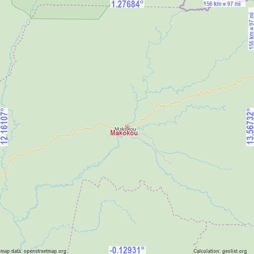
Makokou GPS coordinates[2]
0° 34' 25.716" North, 12° 51' 51.084" East
| Map corner | latitude | longitude |
|---|---|---|
| Upper-left | 1.27684°, | 12.16107° |
| Center: | 0.57381°, | 12.86419° |
| Lower-right: | -0.12931°, | 13.56732° |
| Map W x H: | 156.3×156.4 km | = 97.1×97.2mi |
| max Lat: | 2.07597° ⇑15.4% North |
| Makokou: | 0.57381° |
| min Lat: | ⇓84.6% South -3.43198° |
| min Long | Makokou | max Long |
| 8.78151° | 12.86419° | 14.25905° |
| W 80.8%⇐ | ⇒19.2% E |
Elevation
Elevation of Makokou is 489 m = 1604 ft, and this is 232 m = 761 ft above average elevation for this country.
| Max E: |
667 m = 2188 ft | 23.1% |
| Makokou | 489 m 1604 ft | |
| Avg. | 257 m = 843 ft | |
Min E: |
4 m = 13 ft | 76.9% |
See also: Gabon elevation on elevation.city.
Geographical zone
Makokou is located in North Torrid zone (between Equator and Tropic of Cancer). Distance of Equator is 63.8 km =39.6 mi to South.| Distance of | km | miles | from Makokou |
|---|---|---|---|
| North Pole | 9943.3 | 6178.5 | to North |
| Arctic Circle | 7337.4 | 4559.2 | to North |
| Tropic Cancer | 2542.1 | 1579.6 | to North |
| Equator | 63.8 | 39.6 | to South |


Nearby cities:
15 places around Makokou: (largest is in red/bold)
• Bitam
225.5 km =140.1 mi,  317°
317°
• Booué
126.8 km =78.8 mi,  234°
234°
• Fougamou
322.3 km =200.3 mi, 231°
• Franceville
258.1 km =160.4 mi,  161°
161°
• Koulamoutou
195.3 km =121.4 mi,  193°
193°
• Lastoursville
155.7 km =96.7 mi, 186°
• Lékoni
285.7 km =177.5 mi,  147°
147°
• Mbigou
295 km =183.3 mi,  201°
201°
• Mimongo
281.1 km =174.7 mi,  209°
209°
• Mitzic
148 km =92 mi,  278°
278°
• Moanda
240.9 km =149.7 mi,  171°
171°
• Mounana
222.8 km =138.4 mi, 171°
• Ndjolé
247.9 km =154 mi,  250°
250°
• Okondja
163.7 km =101.7 mi, 146°
• Oyem
182.8 km =113.6 mi,  308°
308°
Sources, notices
• [Note1] Compared only with cities in Gabon existing in our database
• [Src1] Map data: © OpenStreetMap contributors (CC-BY-SA)
• [Src2] Other city data from geonames.org with taken over terms of usage.
• [Src3] Geographical zone / Annual Mean Temperature by Robert A. Rohde @ Wikipedia
