Koulamoutou geodata
Koulamoutou (Ogooué-Lolo) is a seat of a first-order administrative division; located in Gabon in Africa/Libreville (GMT+1) time zone. With population of 16,222 people, there are 8 cities with bigger population in this country. Compared to other cities in Gabon, 50% of cities are located further ↓South; 73.1% of cities are located further ←West and 57.7% of cities have lower elevation than Koulamoutou. Note1


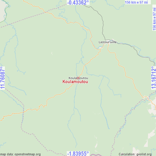
Koulamoutou GPS coordinates[2]
1° 8' 12.012" South, 12° 27' 50.364" East
| Map corner | latitude | longitude |
|---|---|---|
| Upper-left | -0.43362°, | 11.76087° |
| Center: | -1.13667°, | 12.46399° |
| Lower-right: | -1.83955°, | 13.16712° |
| Map W x H: | 156.3×156.3 km | = 97.1×97.1mi |
| max Lat: | 2.07597° ⇑50% North |
| Koulamoutou: | -1.13667° |
| min Lat: | ⇓50% South -3.43198° |
| min Long | Koulamoutou | max Long |
| 8.78151° | 12.46399° | 14.25905° |
| W 73.1%⇐ | ⇒26.9% E |
Elevation
Elevation of Koulamoutou is 282 m = 925 ft, and this is 25 m = 82 ft above average elevation for this country.
| Max E: |
667 m = 2188 ft | 42.3% |
| Koulamoutou | 282 m 925 ft | |
| Avg. | 257 m = 843 ft | |
Min E: |
4 m = 13 ft | 57.7% |
See also: Gabon elevation on elevation.city.
Geographical zone
Koulamoutou is located in South Torrid zone (between Equator and Tropic of Capricorn). Distance of Equator is 126.4 km =78.5 mi to North.| Distance of | km | miles | from Koulamoutou |
|---|---|---|---|
| Equator | 126.4 | 78.5 | to North |
| Tropic Capricorn | 2479.5 | 1540.7 | to South |
| Antarctic Circle | 7274.8 | 4520.3 | to South |
| South Pole | 9880.7 | 6139.6 | to South |


Nearby cities:
15 places around Koulamoutou: (largest is in red/bold)
• Booué
130 km =80.8 mi,  333°
333°
• Fougamou
209.2 km =130 mi,  267°
267°
• Franceville
136.2 km =84.6 mi,  113°
113°
• Lastoursville
44.7 km =27.8 mi,  37°
37°
• Lékoni
205.6 km =127.8 mi,  104°
104°
• Makokou
195.3 km =121.4 mi,  13°
13°
• Mbigou
105.2 km =65.4 mi,  216°
216°
• Mimongo
109.4 km =68 mi,  240°
240°
• Mitzic
236.4 km =146.9 mi, 334°
• Moanda
94.6 km =58.8 mi,  120°
120°
• Mouila
176.4 km =109.6 mi, 242°
• Mounana
82.9 km =51.5 mi, 111°
• Ndendé
186.7 km =116 mi, 221°
• Ndjolé
216.9 km =134.8 mi,  299°
299°
• Okondja
144.9 km =90 mi,  68°
68°
Sources, notices
• [Note1] Compared only with cities in Gabon existing in our database
• [Src1] Map data: © OpenStreetMap contributors (CC-BY-SA)
• [Src2] Other city data from geonames.org with taken over terms of usage.
• [Src3] Geographical zone / Annual Mean Temperature by Robert A. Rohde @ Wikipedia
