Lékoni geodata
Lékoni (Haut-Ogooué) is a populated place; located in Gabon in Africa/Libreville (GMT+1) time zone. With population of 3,583 people, there are 23 cities with bigger population in this country. Compared to other cities in Gabon, 69.2% of cities are located further ↑North; 100% of cities are located further ←West and 80.8% of cities have lower elevation than Lékoni. Note1


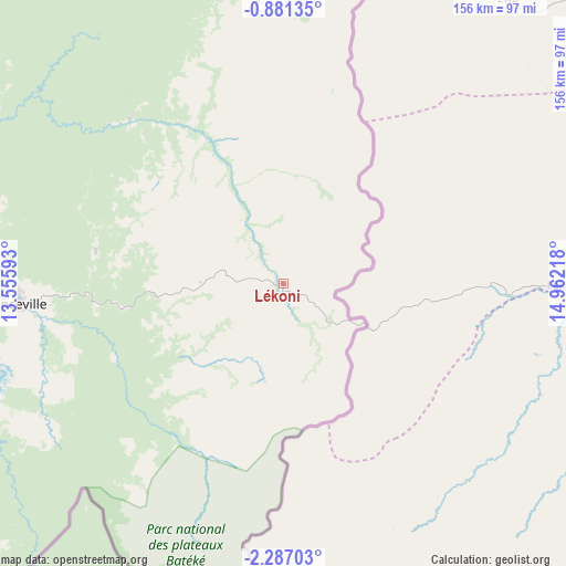
Lékoni GPS coordinates[2]
1° 35' 3.516" South, 14° 15' 32.58" East
| Map corner | latitude | longitude |
|---|---|---|
| Upper-left | -0.88135°, | 13.55593° |
| Center: | -1.58431°, | 14.25905° |
| Lower-right: | -2.28703°, | 14.96218° |
| Map W x H: | 156.3×156.3 km | = 97.1×97.1mi |
| max Lat: | 2.07597° ⇑69.2% North |
| Lékoni: | -1.58431° |
| min Lat: | ⇓30.8% South -3.43198° |
| min Long | Lékoni | max Long |
| 8.78151° | 14.25905° | 14.25905° |
| W 100%⇐ | ⇒0% E |
Elevation
Elevation of Lékoni is 502 m = 1647 ft, and this is 245 m = 804 ft above average elevation for this country.
| Max E: |
667 m = 2188 ft | 19.2% |
| Lékoni | 502 m 1647 ft | |
| Avg. | 257 m = 843 ft | |
Min E: |
4 m = 13 ft | 80.8% |
See also: Gabon elevation on elevation.city.
Geographical zone
Lékoni is located in South Torrid zone (between Equator and Tropic of Capricorn). Distance of Equator is 176.2 km =109.5 mi to North.| Distance of | km | miles | from Lékoni |
|---|---|---|---|
| Equator | 176.2 | 109.5 | to North |
| Tropic Capricorn | 2429.8 | 1509.8 | to South |
| Antarctic Circle | 7225 | 4489.4 | to South |
| South Pole | 9830.9 | 6108.6 | to South |


Nearby cities:
15 places around Lékoni: (largest is in red/bold)
• Booué
306.7 km =190.6 mi,  302°
302°
• Fougamou
410.6 km =255.1 mi,  275°
275°
• Franceville
75.3 km =46.8 mi,  265°
265°
• Koulamoutou
205.6 km =127.8 mi, 284°
• Lastoursville
192.3 km =119.5 mi, 296°
• Makokou
285.7 km =177.5 mi,  327°
327°
• Mbigou
263.9 km =164 mi,  262°
262°
• Mimongo
294.8 km =183.2 mi, 269°
• Mitzic
400 km =248.5 mi,  311°
311°
• Moanda
117.9 km =73.3 mi, 270°
• Mouila
357.4 km =222.1 mi, 264°
• Mounana
123.9 km =77 mi, 279°
• Ndendé
334.9 km =208.1 mi,  254°
254°
• Okondja
122 km =75.8 mi, 327°
• Tchibanga
393.8 km =244.7 mi, 247°
Sources, notices
• [Note1] Compared only with cities in Gabon existing in our database
• [Src1] Map data: © OpenStreetMap contributors (CC-BY-SA)
• [Src2] Other city data from geonames.org with taken over terms of usage.
• [Src3] Geographical zone / Annual Mean Temperature by Robert A. Rohde @ Wikipedia
