Okondja geodata
Okondja (Haut-Ogooué) is a populated place; located in Gabon in Africa/Libreville (GMT+1) time zone. With population of 7,155 people, there are 15 cities with bigger population in this country. Compared to other cities in Gabon, 65.4% of cities are located further ↓South; 96.2% of cities are located further ←West and 61.5% of cities have lower elevation than Okondja. Note1


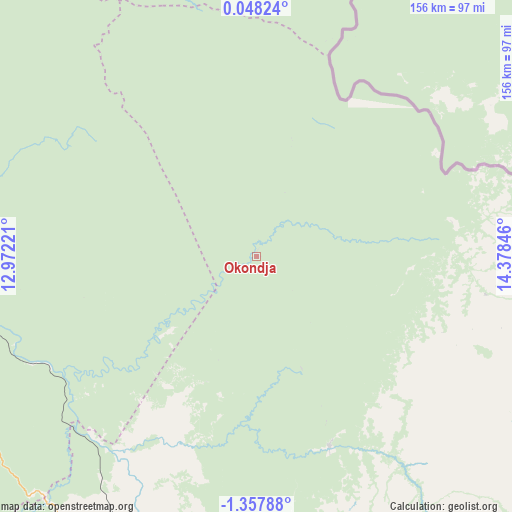
Okondja GPS coordinates[2]
0° 39' 17.532" South, 13° 40' 31.188" East
| Map corner | latitude | longitude |
|---|---|---|
| Upper-left | 0.04824°, | 12.97221° |
| Center: | -0.65487°, | 13.67533° |
| Lower-right: | -1.35788°, | 14.37846° |
| Map W x H: | 156.3×156.4 km | = 97.1×97.2mi |
| max Lat: | 2.07597° ⇑34.6% North |
| Okondja: | -0.65487° |
| min Lat: | ⇓65.4% South -3.43198° |
| min Long | Okondja | max Long |
| 8.78151° | 13.67533° | 14.25905° |
| W 96.2%⇐ | ⇒3.8% E |
Elevation
Elevation of Okondja is 347 m = 1138 ft, and this is 90 m = 295 ft above average elevation for this country.
| Max E: |
667 m = 2188 ft | 38.5% |
| Okondja | 347 m 1138 ft | |
| Avg. | 257 m = 843 ft | |
Min E: |
4 m = 13 ft | 61.5% |
See also: Gabon elevation on elevation.city.
Geographical zone
Okondja is located in South Torrid zone (between Equator and Tropic of Capricorn). Distance of Equator is 72.8 km =45.2 mi to North.| Distance of | km | miles | from Okondja |
|---|---|---|---|
| Equator | 72.8 | 45.2 | to North |
| Tropic Capricorn | 2533.1 | 1574 | to South |
| Antarctic Circle | 7328.4 | 4553.7 | to South |
| South Pole | 9934.2 | 6172.8 | to South |


Nearby cities:
15 places around Okondja: (largest is in red/bold)
• Booué
203 km =126.1 mi,  287°
287°
• Franceville
109.3 km =67.9 mi,  185°
185°
• Koulamoutou
144.9 km =90 mi,  248°
248°
• Lastoursville
109 km =67.7 mi,  260°
260°
• Lékoni
122 km =75.8 mi,  147°
147°
• Makokou
163.7 km =101.7 mi,  326°
326°
• Mbigou
240.5 km =149.4 mi,  234°
234°
• Mimongo
253.7 km =157.6 mi,  244°
244°
• Mitzic
285.3 km =177.3 mi,  304°
304°
• Moanda
114.4 km =71.1 mi,  207°
207°
• Mouila
320.9 km =199.4 mi, 245°
• Mounana
101.6 km =63.1 mi, 214°
• Ndendé
322.5 km =200.4 mi, 232°
• Ndjolé
327.9 km =203.7 mi,  279°
279°
• Oyem
342.2 km =212.6 mi,  317°
317°
Sources, notices
• [Note1] Compared only with cities in Gabon existing in our database
• [Src1] Map data: © OpenStreetMap contributors (CC-BY-SA)
• [Src2] Other city data from geonames.org with taken over terms of usage.
• [Src3] Geographical zone / Annual Mean Temperature by Robert A. Rohde @ Wikipedia
