Gori geodata
Gori (Racha-Lechkhumi and Kvemo Svaneti) is a seat of a second-order administrative division; located in Georgia in Asia/Tbilisi (GMT+4) time zone. In our database, there are 111 cities with bigger population. Compared to other cities in Georgia, 80.3% of cities are located further ↓South; 51.3% of cities are located further →East and 63.2% of cities have lower elevation than Gori. Note1


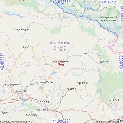
Gori GPS coordinates[2]
42° 31' 0.012" North, 43° 10' 0.012" East
| Map corner | latitude | longitude |
|---|---|---|
| Upper-left | 43.03278°, | 42.46355° |
| Center: | 42.51667°, | 43.16667° |
| Lower-right: | 41.99626°, | 43.8698° |
| Map W x H: | 115.3×115.2 km | = 71.6×71.6mi |
| max Lat: | 43.38111° ⇑19.7% North |
| Gori: | 42.51667° |
| min Lat: | ⇓80.3% South 41.21725° |
| min Long | Gori | max Long |
| 40.07944° | 43.16667° | 46.27667° |
| W 48.7%⇐ | ⇒51.3% E |
Elevation
Elevation of Gori is 705 m = 2313 ft, and this is 126.2 m = 414 ft above average elevation for this country.
| Max E: |
2223 m = 7293 ft | 36.8% |
| Gori | 705 m 2313 ft | |
| Avg. | 578.8 m = 1899 ft | |
Min E: |
1 m = 3 ft | 63.2% |
See also: Georgia elevation on elevation.city.
Geographical zone
Gori is located in North temperate zone (between Tropic of Cancer and the Arctic Circle). Distance of this Northern Tropic circle is 2121.5 km =1318.2 mi to South.| Distance of | km | miles | from Gori |
|---|---|---|---|
| North Pole | 5279.7 | 3280.7 | to North |
| Arctic Circle | 2673.8 | 1661.4 | to North |
| Tropic Cancer | 2121.5 | 1318.2 | to South |
| Equator | 4727.4 | 2937.5 | to South |


Nearby cities:
15 places around Gori: (largest is in red/bold)
• Ambrolauri
0.6 km =0.4 mi,  323°
323°
• Chiat’ura
26.6 km =16.5 mi,  155°
155°
• Java
64.5 km =40.1 mi,  101°
101°
• Kats’khi
25.2 km =15.7 mi,  172°
172°
• Kharagauli
55.1 km =34.2 mi,  177°
177°
• Kutaisi
47.6 km =29.6 mi,  234°
234°
• Lent’ekhi
47.3 km =29.4 mi,  309°
309°
• Oni
23.6 km =14.7 mi,  72°
72°
• Sach’khere
28.2 km =17.5 mi,  132°
132°
• Shorapani
47.9 km =29.8 mi,  187°
187°
• Surami
63.4 km =39.4 mi,  149°
149°
• Tqibuli
23 km =14.3 mi,  216°
216°
• Tsqaltubo
50.6 km =31.4 mi,  247°
247°
• Zestap’oni
46.2 km =28.7 mi, 191°
• Znaur
61.4 km =38.2 mi, 125°
Sources, notices
• [Note1] Compared only with cities in Georgia existing in our database
• [Src1] Map data: © OpenStreetMap contributors (CC-BY-SA)
• [Src2] Other city data from geonames.org with taken over terms of usage.
• [Src3] Geographical zone / Annual Mean Temperature by Robert A. Rohde @ Wikipedia
