Rebola geodata
Rebola (Bioko Norte) is a populated place; located in Equatorial Guinea in Africa/Malabo (GMT+1) time zone. With population of 5,450 people, there are 9 cities with bigger population in this country. Compared to other cities in Equatorial Guinea, 95.8% of cities are located further ↓South; 79.2% of cities are located further →East and 54.2% of cities have higher elevation than Rebola. Note1


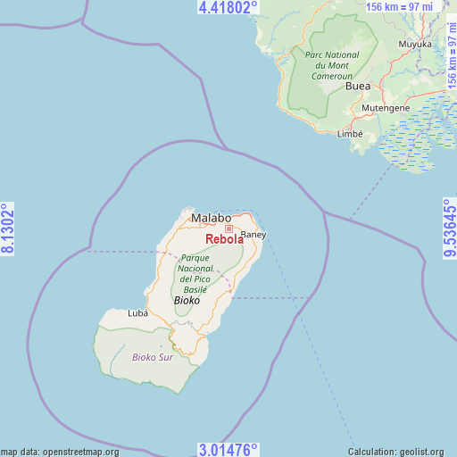
Rebola GPS coordinates[2]
3° 43' 0.012" North, 8° 49' 59.988" East
| Map corner | latitude | longitude |
|---|---|---|
| Upper-left | 4.41802°, | 8.1302° |
| Center: | 3.71667°, | 8.83333° |
| Lower-right: | 3.01476°, | 9.53645° |
| Map W x H: | 156×156 km | = 96.9×96.9mi |
| max Lat: | 3.75578° ⇑4.2% North |
| Rebola: | 3.71667° |
| min Lat: | ⇓95.8% South -1.4068° |
| min Long | Rebola | max Long |
| 5.63178° | 8.83333° | 11.33528° |
| W 20.8%⇐ | ⇒79.2% E |
Elevation
Elevation of Rebola is 394 m = 1293 ft, and this is 22 m = 72 ft above average elevation for this country.
| Max E: |
1278 m = 4193 ft | 54.2% |
| Rebola | 394 m 1293 ft | |
| Avg. | 372 m = 1220 ft | |
Min E: |
4 m = 13 ft | 45.8% |
See also: Equatorial Guinea elevation on elevation.city.
Geographical zone
Rebola is located in North Torrid zone (between Equator and Tropic of Cancer). Distance of Equator is 413.3 km =256.8 mi to South.| Distance of | km | miles | from Rebola |
|---|---|---|---|
| North Pole | 9593.8 | 5961.3 | to North |
| Arctic Circle | 6987.9 | 4342.1 | to North |
| Tropic Cancer | 2192.7 | 1362.5 | to North |
| Equator | 413.3 | 256.8 | to South |


Nearby cities:
15 places around Rebola: (largest is in red/bold)
• Ayene
292.1 km =181.5 mi,  135°
135°
• Añisoc
297.6 km =184.9 mi,  133°
133°
• Bata
230.6 km =143.3 mi,  153°
153°
• Bicurga
298.8 km =185.7 mi, 142°
• Bitica
269.4 km =167.4 mi,  160°
160°
• Ciudad de Riaba
37.9 km =23.5 mi,  192°
192°
• Luba
42.3 km =26.3 mi,  226°
226°
• Machinda
238.7 km =148.3 mi, 148°
• Malabo
7.2 km =4.5 mi,  307°
307°
• Mbini
252.7 km =157 mi, 159°
• Mikomeseng
264.5 km =164.4 mi, 131°
• Moca
46.5 km =28.9 mi,  203°
203°
• Ncue
262.3 km =163 mi, 136°
• Río Campo
188.5 km =117.1 mi, 144°
• Santiago de Baney
8.6 km =5.3 mi,  103°
103°
Sources, notices
• [Note1] Compared only with cities in Equatorial Guinea existing in our database
• [Src1] Map data: © OpenStreetMap contributors (CC-BY-SA)
• [Src2] Other city data from geonames.org with taken over terms of usage.
• [Src3] Geographical zone / Annual Mean Temperature by Robert A. Rohde @ Wikipedia
