Luba geodata
Luba (Bioko Sur) is a seat of a first-order administrative division; located in Equatorial Guinea in Africa/Malabo (GMT+1) time zone. With population of 8,655 people, there are 5 cities with bigger population in this country. Compared to other cities in Equatorial Guinea, 87.5% of cities are located further ↓South; 95.8% of cities are located further →East and 70.8% of cities have higher elevation than Luba. Note1


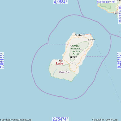
Luba GPS coordinates[2]
3° 27' 24.588" North, 8° 33' 16.74" East
| Map corner | latitude | longitude |
|---|---|---|
| Upper-left | 4.1584°, | 7.85153° |
| Center: | 3.45683°, | 8.55465° |
| Lower-right: | 2.75474°, | 9.25778° |
| Map W x H: | 156.1×156.1 km | = 97×97mi |
| max Lat: | 3.75578° ⇑12.5% North |
| Luba: | 3.45683° |
| min Lat: | ⇓87.5% South -1.4068° |
| min Long | Luba | max Long |
| 5.63178° | 8.55465° | 11.33528° |
| W 4.2%⇐ | ⇒95.8% E |
Elevation
Elevation of Luba is 72 m = 236 ft, and this is 300 m = 984 ft below average elevation for this country.
| Max E: |
1278 m = 4193 ft | 70.8% |
| Avg. | 372 m = 1220 ft | |
| Luba | 72 m = 236 ft | |
Min E: |
4 m = 13 ft | 29.2% |
See also: Equatorial Guinea elevation on elevation.city.
Geographical zone
Luba is located in North Torrid zone (between Equator and Tropic of Cancer). Distance of Equator is 384.4 km =238.9 mi to South.| Distance of | km | miles | from Luba |
|---|---|---|---|
| North Pole | 9622.7 | 5979.3 | to North |
| Arctic Circle | 7016.8 | 4360 | to North |
| Tropic Cancer | 2221.6 | 1380.4 | to North |
| Equator | 384.4 | 238.9 | to South |


Nearby cities:
15 places around Luba: (largest is in red/bold)
• Ayene
296.5 km =184.2 mi,  126°
126°
• Bata
222.4 km =138.2 mi,  142°
142°
• Bicurga
297.7 km =185 mi, 134°
• Bitica
255.1 km =158.5 mi,  152°
152°
• Ciudad de Riaba
24.4 km =15.2 mi,  109°
109°
• Cogo
292.6 km =181.8 mi, 154°
• Machinda
233.9 km =145.3 mi, 138°
• Malabo
41.7 km =25.9 mi,  37°
37°
• Mbini
239.4 km =148.8 mi, 150°
• Mikomeseng
271.7 km =168.8 mi,  122°
122°
• Moca
18.5 km =11.5 mi, 137°
• Ncue
266.3 km =165.5 mi, 126°
• Rebola
42.3 km =26.3 mi,  46°
46°
• Río Campo
187.8 km =116.7 mi, 131°
• Santiago de Baney
47.6 km =29.6 mi,  55°
55°
Sources, notices
• [Note1] Compared only with cities in Equatorial Guinea existing in our database
• [Src1] Map data: © OpenStreetMap contributors (CC-BY-SA)
• [Src2] Other city data from geonames.org with taken over terms of usage.
• [Src3] Geographical zone / Annual Mean Temperature by Robert A. Rohde @ Wikipedia
