Moca geodata
Moca (Bioko Sur) is a populated place; located in Equatorial Guinea in Africa/Malabo (GMT+1) time zone. With population of 1,000 people, there are 23 cities with bigger population in this country. Compared to other cities in Equatorial Guinea, 79.2% of cities are located further ↓South; 91.7% of cities are located further →East and 100% of cities have lower elevation than Moca. Note1


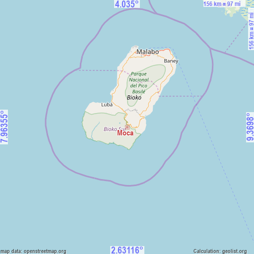
Moca GPS coordinates[2]
3° 19' 59.988" North, 8° 40' 0.012" East
| Map corner | latitude | longitude |
|---|---|---|
| Upper-left | 4.035°, | 7.96355° |
| Center: | 3.33333°, | 8.66667° |
| Lower-right: | 2.63116°, | 9.3698° |
| Map W x H: | 156.1×156.1 km | = 97×97mi |
| max Lat: | 3.75578° ⇑20.8% North |
| Moca: | 3.33333° |
| min Lat: | ⇓79.2% South -1.4068° |
| min Long | Moca | max Long |
| 5.63178° | 8.66667° | 11.33528° |
| W 8.3%⇐ | ⇒91.7% E |
Elevation
Elevation of Moca is 1278 m = 4193 ft, and this is 906 m = 2972 ft above average elevation for this country.
| Max E: |
1278 m = 4193 ft | 0% |
| Moca | 1278 m 4193 ft | |
| Avg. | 372 m = 1220 ft | |
Min E: |
4 m = 13 ft | 100% |
See also: Equatorial Guinea elevation on elevation.city.
Geographical zone
Moca is located in North Torrid zone (between Equator and Tropic of Cancer). Distance of Equator is 370.6 km =230.3 mi to South.| Distance of | km | miles | from Moca |
|---|---|---|---|
| North Pole | 9636.4 | 5987.8 | to North |
| Arctic Circle | 7030.5 | 4368.5 | to North |
| Tropic Cancer | 2235.3 | 1389 | to North |
| Equator | 370.6 | 230.3 | to South |


Nearby cities:
15 places around Moca: (largest is in red/bold)
• Ayene
278.4 km =173 mi,  126°
126°
• Bata
204 km =126.8 mi,  143°
143°
• Bicurga
279.2 km =173.5 mi, 134°
• Bitica
237.2 km =147.4 mi,  153°
153°
• Ciudad de Riaba
11.9 km =7.4 mi,  62°
62°
• Cogo
274.8 km =170.8 mi,  155°
155°
• Luba
18.5 km =11.5 mi,  317°
317°
• Machinda
215.4 km =133.8 mi, 138°
• Malabo
48.7 km =30.3 mi,  15°
15°
• Mbini
221.3 km =137.5 mi, 151°
• Mikomeseng
253.9 km =157.8 mi,  121°
121°
• Ncue
248.2 km =154.2 mi, 126°
• Rebola
46.5 km =28.9 mi, 23°
• Río Campo
169.4 km =105.3 mi, 130°
• Santiago de Baney
48.7 km =30.3 mi,  33°
33°
Sources, notices
• [Note1] Compared only with cities in Equatorial Guinea existing in our database
• [Src1] Map data: © OpenStreetMap contributors (CC-BY-SA)
• [Src2] Other city data from geonames.org with taken over terms of usage.
• [Src3] Geographical zone / Annual Mean Temperature by Robert A. Rohde @ Wikipedia
