Tactic geodata
Tactic (Alta Verapaz) is a populated place; located in Guatemala in America/Guatemala (GMT-6) time zone. With population of 8,999 people, there are 140 cities with bigger population in this country. Compared to other cities in Guatemala, 80.5% of cities are located further ↓South; 71.7% of cities are located further ←West and 56.9% of cities have lower elevation than Tactic. Note1


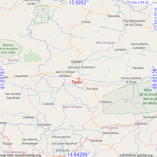
Tactic GPS coordinates[2]
15° 19' 19.848" North, 90° 21' 16.128" West
| Map corner | latitude | longitude |
|---|---|---|
| Upper-left | 15.9992°, | -91.05761° |
| Center: | 15.32218°, | -90.35448° |
| Lower-right: | 14.64296°, | -89.65136° |
| Map W x H: | 150.8×150.8 km | = 93.7×93.7mi |
| max Lat: | 17.06606° ⇑19.5% North |
| Tactic: | 15.32218° |
| min Lat: | ⇓80.5% South 13.9274° |
| min Long | Tactic | max Long |
| -92.19298° | -90.35448° | -88.59444° |
| W 71.7%⇐ | ⇒28.3% E |
Elevation
Elevation of Tactic is 1456 m = 4777 ft, and this is 189 m = 620 ft above average elevation for this country.
| Max E: |
3254 m = 10676 ft | 43.1% |
| Tactic | 1456 m 4777 ft | |
| Avg. | 1267 m = 4157 ft | |
Min E: |
1 m = 3 ft | 56.9% |
See also: Guatemala elevation on elevation.city.
Geographical zone
Tactic is located in North Torrid zone (between Equator and Tropic of Cancer). Distance of this Northern Tropic circle is 902.3 km =560.7 mi to North.| Distance of | km | miles | from Tactic |
|---|---|---|---|
| North Pole | 8303.4 | 5159.5 | to North |
| Arctic Circle | 5697.5 | 3540.3 | to North |
| Tropic Cancer | 902.3 | 560.7 | to North |
| Equator | 1703.7 | 1058.6 | to South |


Nearby cities:
15 places around Tactic: (largest is in red/bold)
• Chicamán
47.8 km =29.7 mi,  273°
273°
• Cobán
16.6 km =10.3 mi,  353°
353°
• Cubulco
38.1 km =23.7 mi,  230°
230°
• El Chol
42.7 km =26.5 mi,  199°
199°
• Purulhá
17.7 km =11 mi,  110°
110°
• Rabinal
30.2 km =18.8 mi,  209°
209°
• Salamá
24.7 km =15.3 mi,  170°
170°
• San Cristóbal Verapaz
24 km =14.9 mi,  290°
290°
• San Jerónimo
31.6 km =19.6 mi,  157°
157°
• San Juan Chamelco
12.6 km =7.8 mi,  10°
10°
• San Miguel Chicaj
25.7 km =16 mi,  189°
189°
• San Pedro Carchá
20.2 km =12.6 mi,  27°
27°
• Santa Cruz Verapaz
9.8 km =6.1 mi,  300°
300°
• Tamahú
12.8 km =8 mi,  96°
96°
• Tucurú
31 km =19.3 mi,  94°
94°
Sources, notices
• [Note1] Compared only with cities in Guatemala existing in our database
• [Src1] Map data: © OpenStreetMap contributors (CC-BY-SA)
• [Src2] Other city data from geonames.org with taken over terms of usage.
• [Src3] Geographical zone / Annual Mean Temperature by Robert A. Rohde @ Wikipedia
