San Juan Chamelco geodata
San Juan Chamelco (Alta Verapaz) is a seat of a second-order administrative division; located in Guatemala in America/Guatemala (GMT-6) time zone. With population of 11,944 people, there are 106 cities with bigger population in this country. Compared to other cities in Guatemala, 85.8% of cities are located further ↓South; 72% of cities are located further ←West and 56% of cities have lower elevation than San Juan Chamelco. Note1


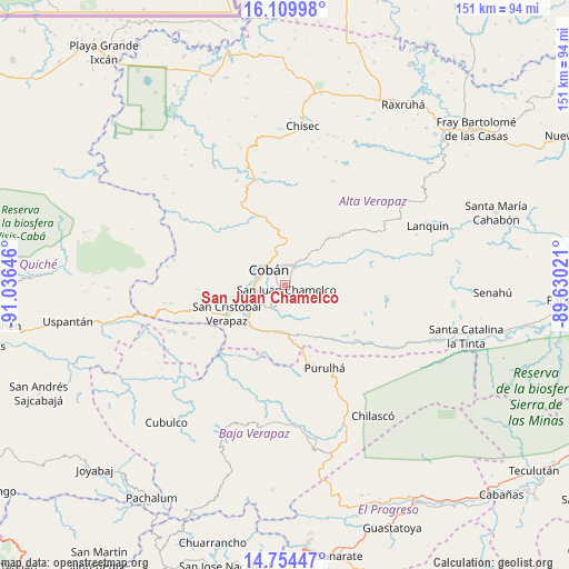
San Juan Chamelco GPS coordinates[2]
15° 25' 59.988" North, 90° 19' 59.988" West
| Map corner | latitude | longitude |
|---|---|---|
| Upper-left | 16.10998°, | -91.03646° |
| Center: | 15.43333°, | -90.33333° |
| Lower-right: | 14.75447°, | -89.63021° |
| Map W x H: | 150.7×150.7 km | = 93.6×93.6mi |
| max Lat: | 17.06606° ⇑14.2% North |
| San Juan Chamelco: | 15.43333° |
| min Lat: | ⇓85.8% South 13.9274° |
| min Long | San Juan Chamel | max Long |
| -92.19298° | -90.33333° | -88.59444° |
| W 72%⇐ | ⇒28% E |
Elevation
Elevation of San Juan Chamelco is 1408 m = 4619 ft, and this is 141 m = 463 ft above average elevation for this country.
| Max E: |
3254 m = 10676 ft | 44% |
| San Juan Chamelco | 1408 m 4619 ft | |
| Avg. | 1267 m = 4157 ft | |
Min E: |
1 m = 3 ft | 56% |
See also: Guatemala elevation on elevation.city.
Geographical zone
San Juan Chamelco is located in North Torrid zone (between Equator and Tropic of Cancer). Distance of this Northern Tropic circle is 889.9 km =553 mi to North.| Distance of | km | miles | from San Juan Chamelco |
|---|---|---|---|
| North Pole | 8291 | 5151.8 | to North |
| Arctic Circle | 5685.1 | 3532.6 | to North |
| Tropic Cancer | 889.9 | 553 | to North |
| Equator | 1716 | 1066.3 | to South |


Nearby cities:
15 places around San Juan Chamelco: (largest is in red/bold)
• Chisec
43 km =26.7 mi,  7°
7°
• Cobán
5.8 km =3.6 mi,  316°
316°
• Cubulco
48.4 km =30.1 mi,  220°
220°
• Lanquín
42 km =26.1 mi,  69°
69°
• Purulhá
23.4 km =14.5 mi,  142°
142°
• Rabinal
42.3 km =26.3 mi,  203°
203°
• Salamá
36.8 km =22.9 mi,  177°
177°
• San Cristóbal Verapaz
25.2 km =15.7 mi,  260°
260°
• San Jerónimo
42.7 km =26.5 mi,  166°
166°
• San Miguel Chicaj
38.2 km =23.7 mi,  189°
189°
• San Pedro Carchá
9.1 km =5.7 mi,  52°
52°
• Santa Cruz Verapaz
13 km =8.1 mi,  235°
235°
• Tactic
12.6 km =7.8 mi, 190°
• Tamahú
17.3 km =10.7 mi, 142°
• Tucurú
32.2 km =20 mi,  117°
117°
Sources, notices
• [Note1] Compared only with cities in Guatemala existing in our database
• [Src1] Map data: © OpenStreetMap contributors (CC-BY-SA)
• [Src2] Other city data from geonames.org with taken over terms of usage.
• [Src3] Geographical zone / Annual Mean Temperature by Robert A. Rohde @ Wikipedia
