Río Blanco geodata
Río Blanco (San Marcos) is a seat of a second-order administrative division; located in Guatemala in America/Guatemala (GMT-6) time zone. With population of 829 people, there are 319 cities with bigger population in this country. Compared to other cities in Guatemala, 68.7% of cities are located further ↓South; 84.7% of cities are located further →East and 97.1% of cities have lower elevation than Río Blanco. Note1


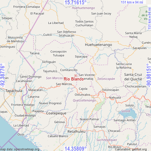
Río Blanco GPS coordinates[2]
15° 2' 17.52" North, 91° 41' 4.668" West
| Map corner | latitude | longitude |
|---|---|---|
| Upper-left | 15.71615°, | -92.38776° |
| Center: | 15.0382°, | -91.68463° |
| Lower-right: | 14.35809°, | -90.98151° |
| Map W x H: | 151×151 km | = 93.8×93.8mi |
| max Lat: | 17.06606° ⇑31.3% North |
| Río Blanco: | 15.0382° |
| min Lat: | ⇓68.7% South 13.9274° |
| min Long | Río Blanco | max Long |
| -92.19298° | -91.68463° | -88.59444° |
| W 15.3%⇐ | ⇒84.7% E |
Elevation
Elevation of Río Blanco is 2626 m = 8615 ft, and this is 1359 m = 4459 ft above average elevation for this country.
| Max E: |
3254 m = 10676 ft | 2.9% |
| Río Blanco | 2626 m 8615 ft | |
| Avg. | 1267 m = 4157 ft | |
Min E: |
1 m = 3 ft | 97.1% |
See also: Guatemala elevation on elevation.city.
Geographical zone
Río Blanco is located in North Torrid zone (between Equator and Tropic of Cancer). Distance of this Northern Tropic circle is 933.8 km =580.2 mi to North.| Distance of | km | miles | from Río Blanco |
|---|---|---|---|
| North Pole | 8335 | 5179.1 | to North |
| Arctic Circle | 5729.1 | 3559.9 | to North |
| Tropic Cancer | 933.8 | 580.2 | to North |
| Equator | 1672.1 | 1039 | to South |


Nearby cities:
15 places around Río Blanco: (largest is in red/bold)
• Cabricán
5.7 km =3.5 mi,  43°
43°
• Cajolá
14.9 km =9.3 mi,  149°
149°
• Comitancillo
9 km =5.6 mi,  309°
309°
• Huitán
5 km =3.1 mi,  75°
75°
• Palestina de los Altos
11.7 km =7.3 mi,  184°
184°
• San Antonio Sacatepéquez
10 km =6.2 mi,  210°
210°
• San Carlos Sija
15.7 km =9.8 mi,  112°
112°
• San Cristóbal Cucho
18.1 km =11.2 mi,  215°
215°
• San Juan Ostuncalco
18.3 km =11.4 mi, 181°
• San Lorenzo
5.5 km =3.4 mi,  261°
261°
• San Marcos
14.4 km =8.9 mi,  234°
234°
• San Miguel Sigüilá
17.6 km =10.9 mi, 154°
• San Pedro Sacatepéquez
11.4 km =7.1 mi, 226°
• Sibilia
8.2 km =5.1 mi,  126°
126°
• Tejutla
16.1 km =10 mi, 305°
Sources, notices
• [Note1] Compared only with cities in Guatemala existing in our database
• [Src1] Map data: © OpenStreetMap contributors (CC-BY-SA)
• [Src2] Other city data from geonames.org with taken over terms of usage.
• [Src3] Geographical zone / Annual Mean Temperature by Robert A. Rohde @ Wikipedia
