Sipacapa geodata
Sipacapa (San Marcos) is a seat of a second-order administrative division; located in Guatemala in America/Guatemala (GMT-6) time zone. With population of 661 people, there are 322 cities with bigger population in this country. Compared to other cities in Guatemala, 75.8% of cities are located further ↓South; 82.3% of cities are located further →East and 74.6% of cities have lower elevation than Sipacapa. Note1


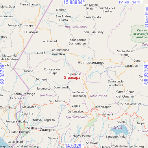
Sipacapa GPS coordinates[2]
15° 12' 44.856" North, 91° 38' 2.976" West
| Map corner | latitude | longitude |
|---|---|---|
| Upper-left | 15.88984°, | -92.33729° |
| Center: | 15.21246°, | -91.63416° |
| Lower-right: | 14.5329°, | -90.93104° |
| Map W x H: | 150.9×150.9 km | = 93.8×93.8mi |
| max Lat: | 17.06606° ⇑24.2% North |
| Sipacapa: | 15.21246° |
| min Lat: | ⇓75.8% South 13.9274° |
| min Long | Sipacapa | max Long |
| -92.19298° | -91.63416° | -88.59444° |
| W 17.7%⇐ | ⇒82.3% E |
Elevation
Elevation of Sipacapa is 1981 m = 6499 ft, and this is 714 m = 2343 ft above average elevation for this country.
| Max E: |
3254 m = 10676 ft | 25.4% |
| Sipacapa | 1981 m 6499 ft | |
| Avg. | 1267 m = 4157 ft | |
Min E: |
1 m = 3 ft | 74.6% |
See also: Guatemala elevation on elevation.city.
Geographical zone
Sipacapa is located in North Torrid zone (between Equator and Tropic of Cancer). Distance of this Northern Tropic circle is 914.5 km =568.2 mi to North.| Distance of | km | miles | from Sipacapa |
|---|---|---|---|
| North Pole | 8315.6 | 5167.1 | to North |
| Arctic Circle | 5709.7 | 3547.8 | to North |
| Tropic Cancer | 914.5 | 568.2 | to North |
| Equator | 1691.5 | 1051 | to South |


Nearby cities:
15 places around Sipacapa: (largest is in red/bold)
• Cabricán
15.4 km =9.6 mi,  185°
185°
• Colotenango
23.1 km =14.4 mi,  338°
338°
• Comitancillo
18.5 km =11.5 mi,  222°
222°
• Concepción Tutuapa
22.8 km =14.2 mi,  277°
277°
• Huehuetenango
21 km =13 mi,  55°
55°
• Huitán
18.2 km =11.3 mi,  181°
181°
• Malacatancito
14.9 km =9.3 mi,  76°
76°
• Río Blanco
20.1 km =12.5 mi,  195°
195°
• San Gaspar Ixchil
21.8 km =13.5 mi,  333°
333°
• San Lorenzo
22.9 km =14.2 mi,  208°
208°
• San Miguel Ixtahuacán
13.9 km =8.6 mi,  298°
298°
• San Rafael Petzal
21.6 km =13.4 mi,  351°
351°
• San Sebastián Huehuetenango
19.6 km =12.2 mi,  5°
5°
• Santa Bárbara
11.5 km =7.1 mi,  0°
0°
• Tejutla
21 km =13 mi,  241°
241°
Sources, notices
• [Note1] Compared only with cities in Guatemala existing in our database
• [Src1] Map data: © OpenStreetMap contributors (CC-BY-SA)
• [Src2] Other city data from geonames.org with taken over terms of usage.
• [Src3] Geographical zone / Annual Mean Temperature by Robert A. Rohde @ Wikipedia
