Murakeresztúr geodata
Murakeresztúr (Zala) is a populated place; located in Hungary in Europe/Budapest (GMT+2) time zone. With population of 1,969 people, there are 803 cities with bigger population in this country. Compared to other cities in Hungary, 90% of cities are located further ↑North; 97.4% of cities are located further →East and 68.2% of cities have lower elevation than Murakeresztúr. Note1


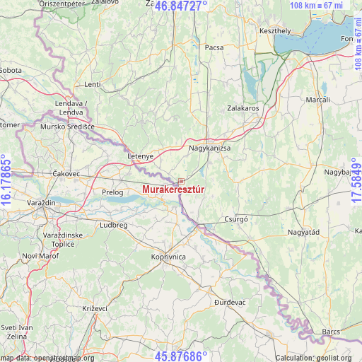
Murakeresztúr GPS coordinates[2]
46° 21' 51.192" North, 16° 52' 54.372" East
| Map corner | latitude | longitude |
|---|---|---|
| Upper-left | 46.84727°, | 16.17865° |
| Center: | 46.36422°, | 16.88177° |
| Lower-right: | 45.87686°, | 17.5849° |
| Map W x H: | 107.9×107.9 km | = 67×67mi |
| max Lat: | 48.46667° ⇑90% North |
| Murakeresztúr: | 46.36422° |
| min Lat: | ⇓10% South 45.79108° |
| min Long | Murakeresztúr | max Long |
| 16.27358° | 16.88177° | 22.68096° |
| W 2.6%⇐ | ⇒97.4% E |
Elevation
Elevation of Murakeresztúr is 135 m = 443 ft, and this is 5.3 m = 17 ft above average elevation for this country.
| Max E: |
444 m = 1457 ft | 31.8% |
| Murakeresztúr | 135 m 443 ft | |
| Avg. | 129.7 m = 426 ft | |
Min E: |
71 m = 233 ft | 68.2% |
See also: Hungary elevation on elevation.city.
Geographical zone
Murakeresztúr is located in North temperate zone (between Tropic of Cancer and the Arctic Circle). Distance of this North polar circle is 2246 km =1395.6 mi to North.| Distance of | km | miles | from Murakeresztúr |
|---|---|---|---|
| North Pole | 4851.8 | 3014.8 | to North |
| Arctic Circle | 2246 | 1395.6 | to North |
| Tropic Cancer | 2549.3 | 1584.1 | to South |
| Equator | 5155.2 | 3203.3 | to South |


Nearby cities:
15 places around Murakeresztúr: (largest is in red/bold)
• Becsehely
12.3 km =7.6 mi,  319°
319°
• Berzence
26.8 km =16.7 mi,  130°
130°
• Böhönye
38.6 km =24 mi,  81°
81°
• Csurgó
20.9 km =13 mi, 126°
• Lenti
39 km =24.2 mi, 317°
• Letenye
14.2 km =8.8 mi,  302°
302°
• Lábod
47.4 km =29.5 mi,  111°
111°
• Marcali
47.4 km =29.5 mi,  58°
58°
• Nagyatád
39.5 km =24.5 mi, 112°
• Nagykanizsa
13 km =8.1 mi,  40°
40°
• Pacsa
40.8 km =25.4 mi,  14°
14°
• Segesd
36.1 km =22.4 mi,  94°
94°
• Sármellék
44.5 km =27.7 mi,  29°
29°
• Zalakomár
30 km =18.6 mi,  49°
49°
• Ötvöskónyi
37.7 km =23.4 mi,  103°
103°
Sources, notices
• [Note1] Compared only with cities in Hungary existing in our database
• [Src1] Map data: © OpenStreetMap contributors (CC-BY-SA)
• [Src2] Other city data from geonames.org with taken over terms of usage.
• [Src3] Geographical zone / Annual Mean Temperature by Robert A. Rohde @ Wikipedia
