Marcali geodata
Marcali (Somogy) is a seat of a second-order administrative division; located in Hungary in Europe/Budapest (GMT+2) time zone. With population of 12,344 people, there are 134 cities with bigger population in this country. Compared to other cities in Hungary, 83.3% of cities are located further ↑North; 92.6% of cities are located further →East and 64% of cities have lower elevation than Marcali. Note1


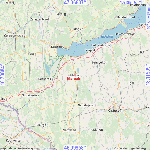
Marcali GPS coordinates[2]
46° 35' 5.928" North, 17° 24' 43.056" East
| Map corner | latitude | longitude |
|---|---|---|
| Upper-left | 47.06607°, | 16.70884° |
| Center: | 46.58498°, | 17.41196° |
| Lower-right: | 46.09958°, | 18.11509° |
| Map W x H: | 107.5×107.5 km | = 66.8×66.8mi |
| max Lat: | 48.46667° ⇑83.3% North |
| Marcali: | 46.58498° |
| min Lat: | ⇓16.7% South 45.79108° |
| min Long | Marcali | max Long |
| 16.27358° | 17.41196° | 22.68096° |
| W 7.4%⇐ | ⇒92.6% E |
Elevation
Elevation of Marcali is 130 m = 427 ft, and this is 0.30000000000001 m = 1 ft above average elevation for this country.
| Max E: |
444 m = 1457 ft | 36% |
| Marcali | 130 m 427 ft | |
| Avg. | 129.7 m = 426 ft | |
Min E: |
71 m = 233 ft | 64% |
See also: Hungary elevation on elevation.city.
Geographical zone
Marcali is located in North temperate zone (between Tropic of Cancer and the Arctic Circle). Distance of this North polar circle is 2221.4 km =1380.3 mi to North.| Distance of | km | miles | from Marcali |
|---|---|---|---|
| North Pole | 4827.3 | 2999.5 | to North |
| Arctic Circle | 2221.4 | 1380.3 | to North |
| Tropic Cancer | 2573.8 | 1599.3 | to South |
| Equator | 5179.8 | 3218.6 | to South |


Nearby cities:
15 places around Marcali: (largest is in red/bold)
• Badacsonytomaj
25.9 km =16.1 mi,  17°
17°
• Balatonberény
15.3 km =9.5 mi,  332°
332°
• Balatonfenyves
15.7 km =9.8 mi, 22°
• Böhönye
19.2 km =11.9 mi,  187°
187°
• Fonyód
22.9 km =14.2 mi,  33°
33°
• Gyenesdiás
22.7 km =14.1 mi,  335°
335°
• Keszthely
24.1 km =15 mi, 327°
• Kéthely
6.9 km =4.3 mi,  348°
348°
• Lengyeltóti
20.1 km =12.5 mi,  61°
61°
• Nagybajom
22.7 km =14.1 mi,  160°
160°
• Segesd
27.5 km =17.1 mi, 189°
• Somogyvár
19.2 km =11.9 mi,  91°
91°
• Sármellék
23.3 km =14.5 mi,  307°
307°
• Vonyarcvashegy
20.6 km =12.8 mi, 338°
• Zalakomár
18.4 km =11.4 mi,  253°
253°
Sources, notices
• [Note1] Compared only with cities in Hungary existing in our database
• [Src1] Map data: © OpenStreetMap contributors (CC-BY-SA)
• [Src2] Other city data from geonames.org with taken over terms of usage.
• [Src3] Geographical zone / Annual Mean Temperature by Robert A. Rohde @ Wikipedia
