Aek Kanopan geodata
Aek Kanopan (North Sumatra) is a seat of a second-order administrative division; located in Indonesia in Asia/Jakarta (GMT+7) time zone. In our database, there are 407 cities with bigger population. Compared to other cities in Indonesia, 97.6% of cities are located further ↓South; 97.6% of cities are located further →East and 74.1% of cities have higher elevation than Aek Kanopan. Note1


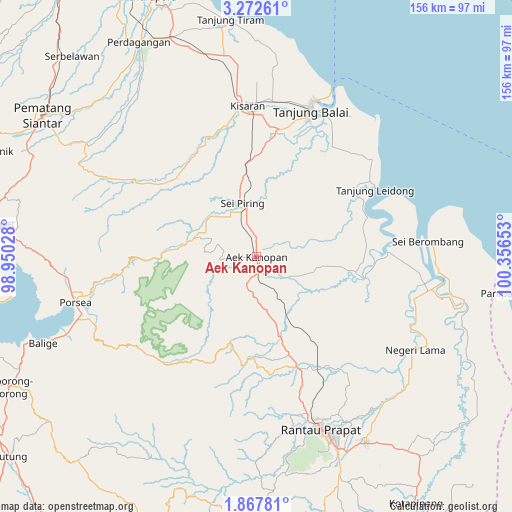
Aek Kanopan GPS coordinates[2]
2° 34' 13.44" North, 99° 39' 12.24" East
| Map corner | latitude | longitude |
|---|---|---|
| Upper-left | 3.27261°, | 98.95028° |
| Center: | 2.5704°, | 99.6534° |
| Lower-right: | 1.86781°, | 100.35653° |
| Map W x H: | 156.2×156.2 km | = 97.1×97.1mi |
| max Lat: | 5.88969° ⇑2.4% North |
| Aek Kanopan: | 2.5704° |
| min Lat: | ⇓97.6% South -10.934° |
| min Long | Aek Kanopan | max Long |
| 95.1345° | 99.6534° | 140.9419° |
| W 2.4%⇐ | ⇒97.6% E |
Elevation
Elevation of Aek Kanopan is 26 m = 85 ft, and this is 203.7 m = 668 ft below average elevation for this country.
| Max E: |
3185 m = 10449 ft | 74.1% |
| Avg. | 229.7 m = 754 ft | |
| Aek Kanopan | 26 m = 85 ft | |
Min E: |
-1 m = -3 ft | 25.9% |
See also: Indonesia elevation on elevation.city.
Geographical zone
Aek Kanopan is located in North Torrid zone (between Equator and Tropic of Cancer). Distance of Equator is 285.8 km =177.6 mi to South.| Distance of | km | miles | from Aek Kanopan |
|---|---|---|---|
| North Pole | 9721.3 | 6040.5 | to North |
| Arctic Circle | 7115.4 | 4421.3 | to North |
| Tropic Cancer | 2320.1 | 1441.6 | to North |
| Equator | 285.8 | 177.6 | to South |


Nearby cities:
15 places around Aek Kanopan: (largest is in red/bold)
• Balige
70.4 km =43.7 mi,  247°
247°
• Bandar
58.8 km =36.5 mi,  169°
169°
• Kisaran
46.2 km =28.7 mi,  354°
354°
• Limapuluh
71.5 km =44.4 mi,  338°
338°
• Pane Tongah
84.3 km =52.4 mi,  296°
296°
• Panyabungan
71.1 km =44.2 mi,  176°
176°
• Parapat
80.5 km =50 mi,  277°
277°
• Pekan Bahapal
80.5 km =50 mi,  318°
318°
• Pematangsiantar
78 km =48.5 mi, 303°
• Rantau Prapat
51.6 km =32.1 mi,  120°
120°
• Rantauprapat
56 km =34.8 mi,  159°
159°
• Siborong-Borong
85.4 km =53.1 mi,  242°
242°
• Sipiongot
81.8 km =50.8 mi, 179°
• Tanjungbalai
47 km =29.2 mi,  20°
20°
• Teluk Nibung
51.2 km =31.8 mi, 20°
Sources, notices
• [Note1] Compared only with cities in Indonesia existing in our database
• [Src1] Map data: © OpenStreetMap contributors (CC-BY-SA)
• [Src2] Other city data from geonames.org with taken over terms of usage.
• [Src3] Geographical zone / Annual Mean Temperature by Robert A. Rohde @ Wikipedia
